As of August 7, a total of 743 wildfires responsible for the destruction of 5,013,053.4 acres of land had been documented in Alaska, making this year's fire season the third most devastating on record.
On August 6, NASA's Terra satellite, launched in December 1999, flew over the state and used its Moderate Resolution Imaging Spectroradiometer (MODIS) instrument to image damaged areas.
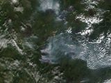
The view, made public by the space agency just hours ago and available in the gallery below, shows wildfires burning around the village of Hughes. Another group of fires is shown further south.
“The top grouping of fires (in the image) broke out around Hughes, Alaska. The village of Hughes has seen very little relief at all this season,” the agency explains. “The bottom group of fires (in the image) is known as the Middle Yukon / Ruby Area fires,” it adds.
As for the red outlines, they show the areas that were actively burning at the time when the Terra satellite journeyed over Alaska and delivered this image of the wildfires then ongoing.
Researchers estimate that, at the time when they were imagined on August 6, the wildfires revealed in this satellite view of Alaska had already burned through about 420,000 acres of land.

 14 DAY TRIAL //
