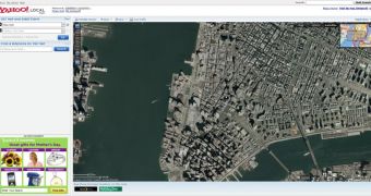
When talking about web-based mapping technologies, users usually think of Google Maps because Google's solution is said to be one of the most powerful tools in this category. However, there are some other similar technologies on the market and, even if their performance is quite remarkable, they were all defeated by Google's popularity. Yahoo Maps is just one of them and, although it is owned by Yahoo, the Sunnyvale-based company couldn't make it a Google Maps rival.
Today, Yahoo announces an important update to Yahoo Maps which makes the web-based mapping tool more useful than anytime before. Just like Google Maps, Yahoo Maps is a free web-based mapping technology which lets users access satellite imagery through their browser.
According to Gus Maldonado, Sr. Product Manager, Yahoo! Geo/Maps, the update brings more worldwide coverage, especially for Eastern Europe, new high-resolution photos and many others. Here are all the improvements as they were presented by Gus Maldonado:
■ New Neighborhood Data at lower zoom levels with: 300 cities with new neighborhood data added throughout North America, from Palo Alto, to Chicago, to Toronto, etc.; 12,000 new neighborhoods added, from "Lower East Side" (New York, Milwaukee, Bridgeport) to "Lower Collegetown" (Ithaca) ■ Expanded Worldwide Coverage with much improved coverage, especially throughout Eastern Europe ■ New POI information - highlighting Schools, Rest areas, Ski Resorts, etc. Additional shaded relief levels worldwide ■ City label density increased for better usability ■ Style improvements such as Hybrid Road and Label colors adjusted for better legibility ■ Lighter map tiles with an average of 30-60% reduction in size
Just like Google Maps, Yahoo Maps provides 3 viewing modes: map, hybrid and satellite. Also, the service provides several zoom levels so that users browsing the maps could control the photos pretty much as they want.

 14 DAY TRIAL //