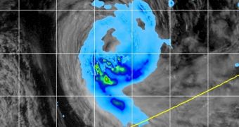
Observations conducted by two satellites yesterday, January 14, have revealed that tropical cyclone Collin, which roams waters south of the equator, in the central Indian Ocean, is slowly unwinding and disorganizing, on its way to becoming a cold-core low pressure area.
The first images of the tropical storm were collected by the NASA Aqua satellite, at 0840 UTC. The spacecraft used its Moderate Resolution Imaging Spectroradiometer (MODIS) instrument to look at the atmospheric event, and determined that clouds and rain were dispersing in all image quadrants.
A second set of images was collected by the Tropical Rainfall Measuring Mission (TRMM) satellite – a joint mission from NASA and the Japan Aerospace Exploration Agency (JAXA) – at 1327 UTC. Readings determined that there is almost no more convection going on at the center of the storm.
At 0900 UTC, the tropical storm exhibited maximum sustained wind speeds of 74 kilometers (46 miles) per hour, and was moving south at a speed of 16.67 kilometers (10.3 miles) per hour. NASA will continue to monitor Collin until it dissipates altogether, PhysOrg reports.

 14 DAY TRIAL //