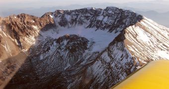
Tomorrow, Saturday March 20, marks the 30th anniversary of the 2.3-magnitude earthquake that shook the ground near Mount St. Helens. Starting that day, the volcano was reawakened, and events precipitated constantly from there on, until finally culminating with the devastating eruption of May 18, 1980. The event took the lives of 57 people, and produced damages that amounted to 1 billion in 1980s dollars. Once and for all, the eruption proved above anything else that it was not by far stable, and that brutal and swift upheavals were not a thing of the past, the US Geological Survey (USGS) reports.
When the volcano blew its top off, it had just exited a period of 123 years of non-activity, which made people confident that it had fallen asleep. But this did not prevent that particular eruption event to be the largest and most destructive in the history of the United States. With little warning to speak off, the Cascade Range of mountains that include St. Helens came to life in just a few months. Public officials and geologists had less than 60 days to figure out what was going on, and this period will for a long time be remembered as one of great activity and uncertainty.
Dark columns of smoke began pouring out of volcano following a widely-heard boom on March 27, 1980, and additional tremors, of at least magnitude 4, rocked the area in the following weeks. New puncture holes appeared in the summit of the mountain, and the ash cloud eventually reached an altitude of about 6,000 feet above the crater. The northern side of the mountain began moving perceptibly, by at least five feet per day, driven by hundreds of smaller of larger earthquakes. These were produced as more and more magma and gas accumulated underneath the rocks that topped the mountain.
But, believe it or not, the eruption also had some positive consequences. Geologists and authorities finally understood that there is a dire need to have sensitive scientific monitoring equipment already installed at disaster-prone locations even before eruptions take place. Officials then found themselves in an awkward situation, as US statistics show the country encompasses some 169 volcanoes that could blow up. At this point, the country uses the USGS to sustain the operations of five dedicated observations centers: Cascades Volcano Observatory, in Washington; the Hawaiian Volcano Observatory; the Long Valley Observatory in California; the Yellowstone Observatory; and the Alaska Volcano Observatory.

 14 DAY TRIAL //