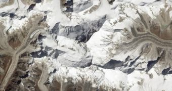
Officials at the American space agency have just released this new image of the Himalaya mountain chain, which features Mount Everest at its very center. The photograph, which showcases many of Earth's fourteen tallest mountain peaks, was collected by the NASA Earth Observing (EO-1) satellite.
Everest, whose Nepalese name Sagarmatha means Mother of the Universe, stands out from most other peaks in other ranges through the fact that it is made up of maritime limestone. Its peak, which now towers over the world, was at the bottom of the ocean just 40 million years ago.
At that time, the Indian subcontinent began a low-speed collision with the Asian continent, and it is the edges of these two colliding tectonic plates that rose from the sea and formed the tallest peaks on our planet. The collision is still occurring today, and will continue to push Everest ever higher for the foreseeable future.
Over the past few years, climbing this peak has become easier, as numerous commercial guides have begun taking trips to its summit. Though it is still considered one of the deadliest peaks in the world, the fatality rate for climbing Everest is just 4 percent. There were 5,656 successful ascensions of Everest, and 223 fatalities recorded until last year.

 14 DAY TRIAL //