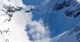
In a demonstration carried out recently, the European Space Agency (ESA) demonstrated that it is possible to use satellites to monitor for avalanches occurring in remote, mountain areas, especially at high and very high latitudes.
Norway is a very good example of such a place. Much of its national territory is extremely remote, and difficult to access by any means. Weather is also impeding monitoring efforts, and so authorities need a new way of keeping track on roads and other critical infrastructure.
With the ESA demonstration, it may become possible to delegate these responsibilities to satellites in Earth's orbit. With this capability, Norwegian authorities would know as soon as an avalanche is produced, and a road is blocked.
By intervening quickly, the country could reduce its economic losses, that are now caused by backed-up traffic and cargo transport in remote areas that have been covered in snow. The main beneficiary of the monitoring system would be the Norwegian Public Roads Administration (NPRA).
Working through its Earth Observation Data User Element program, the European space agency carried out a pilot study called Innovators II–AvalRS in order to assess whether orbital monitoring is possible.
By using very high-resolution optical satellite imagery with datasets including digital terrain models, a large number of avalanches were immediately found. This proof-of-concept study can therefore be considered a success, which means that this avenue may be explored by other countries as well.
The use of state-of-the-art pattern recognition methods is however absolutely necessary to conducting such observations. The texture of the avalanche deposits and the topographic features of the avalanche are the two main factors these techniques look for.
Some of the challenges that remain to be solved include giving satellites the ability to distinguish between shadows and rocks. Classifying areas that are in shadow is also difficult at this point.
“If these remaining challenges can be overcome, this new method will give us a unique opportunity to validate the occurrence of avalanches,” NPRA expert Heidi Bjordal explains.
At this point, it is still unknown whether ESA will conduct such monitoring when the system is validated, if it will be using existing satellites, or if it will launch new capabilities to cover this need.

 14 DAY TRIAL //