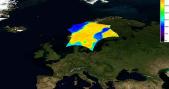
The European Space Agency (ESA) launched the Soil Moisture and Ocean Salinity (SMOS) satellite on November 2. The primary goal of this mission was to assess global soil moisture and ocean salinity variations, so as to provide experts with a clearer, more in-depth understanding of our planet's water cycles. Now, less than four months into the flight, the spacecraft is already sending back its first calibrated images of Earth's surface, which are essentially “brightness temperature” maps. These data have significant practical applications in the fields of agriculture and water resource management.
Officials at the space agency say that these two variables are all that's needed in order to analyze and understand in depth the exchange processes taking place between the planet's surface and its atmosphere. Datasets obtained in this manner could then be used to add even more precision to existing computer models that, at this point, simulate future weather and climate patterns. Collecting this information is, however, a very complicated process, experts say, as the “brightness temperature” maps need to be converted into soil moisture and ocean salinity data through complex processing.
What these maps produce is basically a representation of how radiation is emitted back after hitting our planet's surface. During the first months of the mission, managers and engineers handling SMOS had their work cut out for them in ensuring that the calibration of the satellite is at optimum levels. This is extremely important, because the two variables, and the subsequent model that will include them, will be based on these raw temperature brightness maps. This is the main reason why researchers are so ecstatic that they are able to produce useful science only four months into the flight.
“Our development team is extremely happy and proud to see the real performance of the SMOS system in orbit. We are only half-way through the in-orbit commissioning phase and it is rewarding to see these first very promising calibrated products delivered by SMOS,” explains ESA official Achim Hahne, who is the project manager for the satellite. “SMOS has delivered its first products earlier than expected and of a quality better than the specifications,” adds scientist Yann Kerr, the expert who first proposed this mission to the space agency.
“For the ocean products, a lot of work still has to be done before the release of operational data. The low sensitivity to variations in salinity requires very accurate instrument calibration and data processing to achieve the mission’s measurement goals for ocean salinity. However, the excellent performance of MIRAS [the Microwave Imaging Radiometer with Aperture Synthesis instrument], and the work being done in commissioning means we are very close to obtaining good results for measuring salinity,” concludes the SMOS ocean salinity lead investigator, Jordi Font.

 14 DAY TRIAL //