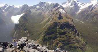
Throughout the world, the existence of U-shaped valleys featuring a distinct shape and composition have been attributed to the action of glaciers over millions of years. Recently, a team of scientists developed a model that can indicate how these areas looked like before the ices took hold.
Glacier valleys are produced as millions of tons of ice slowly grind downhill, with the flow of glaciers. As this happens, everything from small pebbles to large boulders are picked up, and then slowly moved forward under the pressure of all that weight.
These rocks cause a specific type of erosion. Over millions of years, glaciers can literally carve in solid ground, producing the valleys and other landscape features we're used to today.
But geologists have been trying for centuries to gain a better understanding of how the mountains looked like before the ices. This may in turn help other fields of research, such as geology, seismology, and also the study of Earth's interior.
Now, experts at the University of California in Berkeley (UCB) and the Berkeley Geochronology Center (BGC) announce that they managed to create a new computer model, that can reconstruct ancient landscapes, at least in certain areas of the world.
The new technique was applied to a 300-square-mile area of Fiordland, in New Zealand. The model covered a time frame spanning from 2.5 million years ago (the Pleistocene epoch) to modern times.
The Pleistocene was chosen as a reference time because this is when the planet started to cool gradually. Most glaciers that left behind valleys and other marks in the world appeared at that time.
“The first question we asked was, how much of the current landscape and relief is a result of glacial erosion? The answer is, all of it,” says David Shuster.
The expert, an associate adjunct professor of Earth and planetary science at UCB and a geochemist at the BGC, was the one who developed the technique, called helium-4/helium-3 thermochronometry.
“Geologists have wondered, what did the landscape look like 200,000 years ago, or 400,000 years ago, or back before the Pleistocene glaciations began?” glaciologist Kurt Cuffey adds.
“Did the valleys start out as V-shaped canyons submerged in ice, and the glacier just widened and deepened them? Or perhaps the relief was sculpted by glaciation, and it didn’t matter what the rock landscape looked like before,” he says.
Cuffey is a professor and chair of geography and a professor of Earth and planetary science at UCB.
The new study was supported by funds from the US National Science Foundation (NSF). BGC experts were supported by a grant from the Ann and Gordon Getty Foundation.

 14 DAY TRIAL //