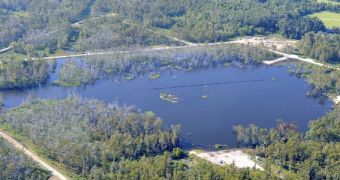
According to the conclusions of a new scientific study, it would appear that airborne radar ground measurements can be used to successfully identify forming sinkholes before they collapse, potentially leading to significant loss of property and human life.
The analysis revealed that data collected by NASA in 2012 could have been interpreted to detect the Bayou Corne sinkhole that developed in northern Assumption Parish, Louisiana, two years ago. Experts found that Uninhabited Airborne Vehicle Synthetic Aperture Radar (UAVSAR) instruments are best suited for this application.
Scientists at the NASA Jet Propulsion Laboratory (JPL) in Pasadena, California, led by researchers Cathleen Jones and Ron Blom, used data collected from a UAVSAR aboard a C-20A jet aircraft to look for potential clues about forming sinkholes; only datasets from 2011 and 2012 were used.
Blom and Jones say that UAVSAR-like assets produce interferometric synthetic aperture radar (InSAR) imagery that is capable of revealing even minute variations in soil elevation, even from great altitudes.
This implies that an efficient early-warning system could be set up, wherein radar instruments aboard aircraft and/or satellites are used to routinely monitor the entire surface of the United States for any potential sinkholes. Special algorithms could be used to detect dangerous soil height variations autonomously.
Sinkholes are naturally-occurring phenomena that form when the surface layers of the ground collapse into deep caverns underneath. These holes appear unexpectedly and can claim lives and properties in a flash. They are relatively common alongside the Louisiana Gulf Coast and in Florida.
“While horizontal surface deformations had not previously been considered a signature of sinkholes, the new study shows they can precede sinkhole formation well in advance. This kind of movement may be more common than previously thought, particularly in areas with loose soil near the surface,” says Jones. Details of the new study were published in the February issue of the esteemed journal Geology.
The InSAR data showed ground surface layer deformations at the site of the future Bayou Corne sinkhole about one month before the ground collapsed. Horizontal motions totaled 260 millimeters (10.2 inches), and covered an area about 500 by 500 meters (1,640 by 1,640 feet). The sinkhole itself covered 1 hectare (around 2 acres).
“Our work shows radar remote sensing could offer a monitoring technique for identifying at least some sinkholes before their surface collapse, and could be of particular use to the petroleum industry for monitoring operations in salt domes,” Blom explains.
“Salt domes are dome-shaped structures in sedimentary rocks that form where large masses of salt are forced upward. By measuring strain on Earth's surface, this capability can reduce risks and provide quantitative information that can be used to predict a sinkhole's size and growth rate,” he concludes.

 14 DAY TRIAL //