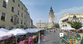
Google is welcoming another country to Street View, Poland. Street View has been expanding in Eastern Europe lately, it recently started shooting in the Czech Republic and is now doing the same in the neighboring Poland.
It's a big launch, Google has covered the important parts of the country which are available online from day one.
If you've thought about visiting or want to check out what your hometown looks like these days, you can head to Google Maps to do it.
"This June, the eyes of soccer fans from around the world will be on Poland and Ukraine as they host the 2012 European Football Championship," Google explained.
"In addition to the more than one million tourists expected to visit Poland alone, now everyone can explore this beautiful country that just became available via the Street View," it announced.
There's certainly plenty to see in the country and all of the best, or at least the most famous places are available in Street View.
Krakow is entirely covered by Street View, the city has a long history stretching back more than a millennia. In fact, the earliest settlements in that area date back to the Stone Age, though you probably won't see much of that in Street View. What you will see though are places like the Main Square, a big tourist hub.
Of course, Poland's capital and biggest city Warsaw is also represented, so you can check out the historic parts like the Old Town, which is now a UNESCO World Heritage Site.
A few other large cities have also been shot by the Street View cars and Google will probably be covering the rest over time. For now, you won't get the full coverage you see in Germany or the UK, but the most important places are all there.

 14 DAY TRIAL //