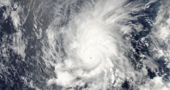
Folks with NASA's Earth Observatory have recently released this photo showing hurricane Amanda hanging about in the Eastern Pacific as seen from space, and the image is now making rounds on the Internet.
Space tells us that the photo was taken this past May 25. At that time, hurricane Amanda was a category-4 storm and packed winds whose speed reached an impressive 155 miles per hour (about 250 kilometers per hour).
Courtesy of its strength, Amanda is the first named storm of this year's hurricane season in the Eastern Pacific. The good news is that, according to specialists who are busy monitoring it, the storm has little to no chances to affect land.
More so given the fact that, since the time the photo was taken until present day, it has weakened to a considerable extent. Thus, on Wednesday, the storm's winds only had a speed of 65 miles per hour (approximately 105 kilometers per hour).
The hurricane season in the Eastern Pacific begins on May 15 and ends on November 30. The hurricane season in the Atlantic, on the other hand, is set to debut this coming Sunday and will also run until November 30. Hence, we should expect to see other such storms form in the months to come.

 14 DAY TRIAL //