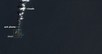
A recent satellite image of a sector in the western Pacific Ocean has revealed that an island which began rising from the water in November 2013 has now merged with its neighbor. The latter was formed through a similar process between 1973 and 1974. Both of these features were produced by a seafloor volcano deep underwater, researchers say.
When the volcano began erupting, a little over four months ago, scientists noticed that sufficient material had been spewed up to break through the ocean's surface. A new image taken with the Landsat 8 satellite – which is operated by NASA and the United States Geological Survey (USGS) – now reveals that the new island, called Niijima, merged with the previous one, called Nishino-shima.
Last November, the two were separated by 500 meters (1640 feet) of open water, but the underwater volcano released enough material to cover the gap, and shows no signs of stopping. The phenomenon was imaged using the Operational Land Imager (OLI) instrument aboard Landsat 8. The new island lies in the Ogasawara Island chain, some 1,000 kilometers (600 miles) south of Tokyo, Japan.
According to the latest measurements, the Niijima sector of the new island is larger than the original formation, Nishino-shima. The entire ensemble measures around 1,000 meters (3,280 feet) across. Studying how this new island grows from the waters of the Pacific Ocean reveals additional data about how other, larger archipelagos formed around the world, after hundreds or thousands of eruptions.

 14 DAY TRIAL //