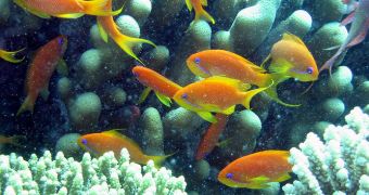
Scientists interested in analyzing the evolution of coral reefs in the Red Sea announce the development of a new map showing the formations. The dataset, which includes satellite, aerial and ship-based measurements, was compiled by a team of researchers from the United States. The main focus of the investigation was a group of little-known coral reefs, located along the Saudi Arabia coast. The resulting map covers a swath of land stretching from Egypt all the way to Yemen, and covers a surface of about 25,000 square kilometers.
This is the second-largest such reef survey in the world. The most massive one was conducted on American reefs, and was directed by the US National Oceanic and Atmospheric Administration (NOAA). During that investigation, more than 30,000 square kilometers of ocean surface were surveyed, Nature News reports. However, researchers with the new endeavor argue that their effort showcases a lot more detail of the actual reefs than the NOAA-based investigation did. The improvements are remarkable, they say, explaining that their map has a 7-meter resolution, whereas the NOAA document only has a 1,000-meter resolution.
The new effort was led by Nova Southeastern University (NSU) National Coral Reef Institute (NCRI) expert Sam Purkis. The map itself shows that the marine ecosystems around the reefs feature a massive amount of diversity. The Red Sea apparently contains a number of wonderful features, including barrier reefs, atoll-like features, coastal fringes, amoeba-like shapes, elongated banks, and shallow reefs. “We're seeing shapes and morphologies we don't even have names for,” Purkis said yesterday in Portland, Oregon, at the biennial Ocean Sciences Meeting of the American Geophysical Union (AGU).
The group determined that the Red Sea region wasn't always such a dry place as it is today. A long time ago, the arid area was completely different, a fact that seems to explain some of the peculiar shapes the recent survey identified. “It's hyper-arid at the moment, but between 6,000 and 10,000 years ago, the Saharan region was influenced by monsoon-like activity, producing perhaps tenfold greater rainfall than today,” Purkis said. “If we take a block of carbonate rock and expose it to rainfall synthetically for several thousand years, we can recreate the morphologies we see in the Red Sea reefs very effectively,” he concludes.

 14 DAY TRIAL //