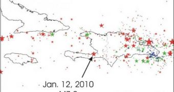
As the impoverished nation of Haiti is struggling to rebuild itself following the earthquake that devastated its population in January 2010, experts are not painting a very encouraging picture. The latest seismic risk maps are very worrying, analysts say.
These maps are created precisely to help Haitian authorities decide on the best ways to rebuild their country. But the outcomes of the decisions they make are not necessarily in their hands, experts add.
The nation is located above a very active and unstable collection of fault lines and subduction zones, all of which interact in an extremely complex manner. The energy released when two tectonic plates snap free from each other is what triggers tremors.
Scientists say that the area around Haiti is primed to be subjected to yet another powerful earthquake, and that authorities should take this into account when defining new strategies for moving forward.
The January 12, 2010, earthquake that devastated the island nation had a magnitude of 7, and killed in excess of 200,000 people (230,000 people by some sources). More than 1.5 million were left homeless by the devastation, LiveScience reports.
The new map “doesn't say whether to build or not. It just tells what the hazard is,” explains Arthur Frankel. He is a member of the United States Geological Survey (USGS) team that created the map.
According to the new study, the largest risk is still recorded along the Enriquillo-Plantain Garden fault, which is the area that spawned the 2010 tremor. The Septentrional fault and the western end of the Muertos Trough are also extremely sensitive.
“We try to stress that there's a lot of uncertainly,” Frankel adds, referring to the countless, smaller fault lines that have been thrown off-balance by the previous seismic event. Unlike the larger tectonic plates in the area, the smaller ones have not been researched thoroughly.
This would be very difficult to do, given the sophisticated nature of the instruments needed to conduct such a study. It's not often that USGS experts have the chance to bring the necessary equipment to sites outside the United States.
However, seismologists are doing the best they can with available materials, and are also using Global Positioning System (GPS) data to determine by how much the fault lines in the area are moving about.

 14 DAY TRIAL //