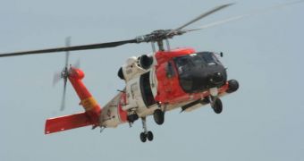
In a new, inter-agency effort, the United States now benefit from one of the most advanced search and rescue pattern programs in the world. The result of a collaboration between the National Oceanic and Atmospheric Administration (NOAA), the Mid-Atlantic Coastal Ocean Observing Regional Association, the US Coast Guard, and the Department of Homeland Security, the newly collected data are now part of the Integrated Ocean Observing System (IOOS®). The new information maps underwater currents on the country's coastline and offers predictions as to where victims of accidents may have drifted, depending on their relative position.
This type of knowledge is extremely important for any rescue effort. In the freezing waters of the ocean, the first few hours are crucial. Therefore, authorities that are usually in charge of search and rescue efforts, starting with the US Coast Guard, need to establish a viable perimeter of search as soon as possible. The emergency personnel now hope that IOOS® could be the instrument that provides them with this knowledge at a single press of a button. Such a quick answer would allow for the immediate deployment of rescue crews, in both helicopters and boats, and would increase a shipwreck victim's chances of survival.
For the new database, high-frequency lasers were used to assess the surface currents in the oceans, and emergency workers will gain access to this knowledge almost in real time, in the near future. Then, from a Coast Guard control post, relief efforts will be coordinated with a much higher degree of accuracy, according to the readings in the system. In addition to saving human lives, the IOOS® could also be used to more effectively contain oil spills, to monitor the uncontrolled spread of algae, as well as to analyze the quality of water within a given area.
“IOOS is known for providing information about tracking, managing and adapting to changes in the marine environment. Using it operationally for search and rescue is an important step. This is about saving lives,” the Director of NOAA's IOOS® program, Zdenka Willis, said. “The Coast Guard is continuously striving to enhance its Search and Rescue capabilities by obtaining the latest operational environmental products that NOAA has to offer. Better data means search efforts can be focused on smaller areas, saving more lives by allowing us to locate and assist distressed persons more quickly,” Search and Rescue Optimal Planning System (SAROPS) Program Manager Jack Frost, from the USCG, added.
“From the recreational fisherman to the family swimming at the beach, people in the Mid-Atlantic region will enjoy a safer life as a direct benefit of applying joint technology and understanding to meet community needs,” the Executive Director of the Mid-Atlantic Coastal Ocean Observing Regional Association, Judith Krauthamer, concluded.

 14 DAY TRIAL //