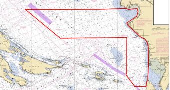
A whole bunch of ships operated by the US National Oceanic and Atmospheric Administration (NOAA) is currently being prepared for a large hydrological survey, which the federal agency plans to conduct in 2011. Independent contractors that will participate are also getting ready for the task.
The endeavor is a part of the nation’s 177th hydrographic surveying season. In 2011, plans are to analyze some 2,525 square nautical miles of high-traffic coastal waters.
The targeted area is located off the continental United States and Alaska, and experts want to understand what's going on at those locations by collecting critical ocean and coastal mapping data.
Keeping a close eye on US waters, and monitoring them yearly, is very important, because coastal environments are constantly changing due to factors such as erosion, storms, and other processes.
There are over 3.4 million square nautical miles that the US has control over, and also a huge stretch of coastlines. All of this territory needs to be covered if authorities are to have a complete picture of what's going on.
“The science of these surveys underpins the steady flow of commerce and the safety of mariners and coastal communities,” explains the director of the Office of Coast Survey, NOAA Corps Capt. John E. Lowell. He is also a US national hydrographer.
According to official statistics, more than 13 million jobs and $742 billion are dependent on marine economy and commerce, and this makes this area critically-important for the federal government.
One of the primary prerogatives that NOAA has is to ensure that this portion of the American economy functions as steadily and smoothly as possible. It needs to ensure the continued flow of commerce.
As part of these efforts, the NOAA Office of Coast Survey (OCS) is the keeper and manager of the 1,000+ nautical charts that make up the national map suite for territorial waters and coastlines.
In order to maintain the accuracy of the maps, the OCS is conducting annul hydrographic surveys, which enables it to update and modify all existing charts accordingly. This helps reduce the amount of navigational hazards on the seafloor.
The updating process is very complex, and any final decisions that are made also consider requests made by marine pilots, port authorities, the Coast Guard, researchers and other actors.
The three ships that will be used for the 2011 survey, the Fairweather, the Rainier, and the Thomas Jefferson, are part of the NOAA fleet of research ships and aircraft operated by the NOAA Office of Marine and Aviation Operations.

 14 DAY TRIAL //