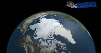
Ahead of launching a new spacecraft in its Earth Observing System, NASA begins conducting a new study of the massive ice sheet covering Greenland. A research aircraft flew to the North Atlantic island on Wednesday, ready to start conducting a series of measurements that will eventually help scientists develop precise baseline measurements to be used in conjunction with data provided by future satellite missions.
The C-130 research airplane took off from the Wallops Flight Facility, in Wallops Island, Virginia. Its job will be to conduct a series of survey flights over Greenland, which will provide additional information on how seasonal ice melt occurs in this ice sheet.
These baseline measurements will then be used as guidelines for the Ice, Cloud, and land Elevation Satellite 2 (ICESat-2) mission, which is currently scheduled to launch in 2016 from the Vandenberg Air Force Base, in California.
Studying seasonal ice variations is very important because significant height differences have been observed in glaciers between summer and winter months. For example, the Jakobshavn Glacier has previously been demonstrated to decline by as much as 33 meters (100 feet) during the summer, compared to its height in the winter.
Experts say that differences such as these are more characteristic of Greenland's low-laying areas than of glaciers at higher altitudes. Ice packs located high on the island's mountains usually only decline by a few inches during the summer.
“The more ground we cover the more comparison points we'll have for ICESat-2,” explains NASA Goddard Space Flight Center (GSFC) expert Bryan Blair, who is the principal investigator for the Land, Vegetation and Ice Sensor (LVIS) on the research aircraft.
The research team will measure ice sheet variations using the LVIS airborne laser altimeter and a smaller version of the same device, called LVIS-GH. Both instruments will study overlapping swats of ice from about 8,500 meters (28,000 feet).
“We plan to concentrate our flights on areas northwest, southeast and southwest Greenland and the Arctic Ocean. The measurements we collect along lines sampled in IceBridge's spring 2013 Arctic campaign will allow scientists to assess changes over the summer,” says GSFC LVIS mission scientist Michelle Hofton.

 14 DAY TRIAL //