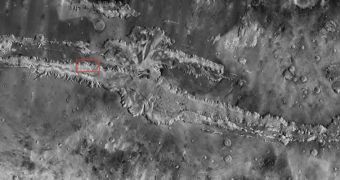
Scientists at the Arizona State University have just brought online the most detailed map of the Martian surface ever produced. Created by combining about 21,000 images obtained by the NASA Mars Odyssey orbiter, the map reveals our neighboring planet in infrared wavelengths, providing an excellent learning tool for teachers, students and the general public. The information was collected using the Thermal Emission Imaging System (THEMIS) multi-band infrared camera, Space reports.
Mars Odyssey has been in orbit around the Red Planet since 2001, and is widely considered to be one of the most important spacecraft ever devised. Throughout its lifetime, it managed to produce invaluable images of features on the Martian surface, which contributed to advancing our understanding of various natural phenomena going on there. When the Mars Exploration Rovers Spirit and Opportunity landed in 2004, the Odyssey began acting as a relay for the robots, allowing them to retain more power in their batteries, rather than spending it on their high-gain antennas.
The new map, combining the best data made available by THEMIS, was created and made available by investigators at the Tempe, Arizona-based ASU Mars Space Flight Facility. Scientists at the NASA Jet Propulsion Laboratory (JPL), in Pasadena, California, also contributed to the endeavor, participating in processing the images, as well as in stitching them together one by one. “We've tied the images to the cartographic control grid provided by the US Geological Survey, which also modeled the THEMIS camera's optics. This approach lets us remove all instrument distortion, so features on the ground are correctly located to within a few pixels and provide the best global map of Mars to date,” explains the director of the Mars Space Flight Facility, Philip Christensen.
“The broad purpose underlying all these sites is to make Mars exploration easy and engaging for everyone. We are trying to create a user-friendly interface between the public and NASA's Planetary Data System, which does a terrific job of collecting, validating and archiving data,” the expert, who is also the principal investigator of the THEMIS instrument, says. “The Mars Odyssey THEMIS team has assembled a spectacular product that will be the base map for Mars researchers for many years to come. The map lays the framework for global studies of properties such as the mineral composition and physical nature of the surface materials,” concludes JPL Odyssey project scientist Jeffrey Plaut.

 14 DAY TRIAL //