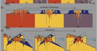
A group of investigators from the Netherlands has recently augmented an existing model on soil sedimentation and erosion with data on the subsoil, thus producing one of the most advanced tools for simulating the way rivers and deltas develop over geological times.
The team, based at the Delft University of Technology (TU Delft), added the subsoil data on the sedimentation and erosion model in an attempt to get a clearer picture of what was going on at locations were deltas form, or where rivers carve up deep valleys.
Studies such as this one could have important applications in fields of civil engineering such as delta management, where understanding the interplay that develops between the subsoil and the river-delta system's flow processes is critical.
Additional uses of the new data are also possible in geology, where reservoir geologists could find it a lot easier to analyze underground deposits. The new study was led by expert Nathanaël Geleynse.
The work was published in the recent issues of the esteemed scientific journals Geophysical Research Letters and Earth and Planetary Science Letters, AlphaGalileo reports. The study was conducted due to the fact that experts wanted to gain more insight into how rivers form deltas.
But the creation of such a system is a tremendously complex process, one that is influenced by a wide variety of external factors, such as the type of sediment the river transports, the type of clay or sand particles in the water, and the extent of tidal differences at the shoreline.
Also of importance in determining how the delta will develop is the height at which the winds around the shorelines raise waves. What the TU Delft team shows is that the subsoil has an equally-important influence on the overall development of forming deltas.
Geleynse and his colleagues used the Delft3D software as a basis, and added their subsoil data to the already-complex computer model.
“Existing data do not enable us to give ready-made answers to specific management questions. […] nature is not so easily tamed, […] but they do offer plausible explanations for the patterns and shapes we see on the surface,” the team leader explains.
“The flow system carries the signature of the subsoil, something we were relatively unaware of until now. Our model provides ample scope for further development and for studying various scenarios in the current structure,” he goes on to say.

 14 DAY TRIAL //