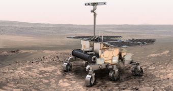
Scientists at the American space agency are currently working hard towards creating new technologies that will enable rovers conducting exploration efforts on other worlds to steer themselves, select their own targets, and then analyze them according to a set of instructions.
Currently, it takes a lot of time for radio signals sent from Earth to reach spacecraft on or around Mars, in the orbits of Mercury, Venus, Saturn or the giant asteroid Vesta. It then takes the same amount of time for the signal to get back. Depending on the distance, many minutes can pass.
Between Earth and the Red Planet, for example, the delay can amount to 20 minutes, which is not very useful if you want to drive the Mars Exploration Rover (MER) Opportunity around a treacherous obstacle, or the Mars Science Laboratory (MSL) rover Curiosity up the slopes of a mountain.
For such applications, as well as for target identification, NASA is planning to develop software that would autonomously detect potentially-interesting rocks, set a safe course to that destination, and then begin conducting scientific analysis, all while the signal announcing the discovery is still en route.
In order to achieve this capability, scientists need to replicate human visual recognition in robots. This is a bit tricky, since experts don't yet fully understand how this works in our own species, Space reports.
“Our goal is to make smart instruments that can do more within each command cycle,” explains expert David Thompson, who is based at the NASA Jet Propulsion Laboratory (JPL), in Pasadena, California.
Thompson is also the leader of the TextureCam project, an effort to create a computer vision package capable of identifying specific geological features on a given terrain. In the case of Mars exploration, this would translate into separating the boulders and fallen meteorites from the omnipresent dust.
TextureCam instruments would not necessarily be limited to uses on rovers. They could be used by spacecraft during flybys of comets and asteroids, as well as by gliders, balloons and other aircraft hovering above the surface of alien worlds.
“The field being investigated by David Thomson is vital to cope with the flood of remote sensing data returned from spacecraft,” comments Aberystwyth University expert Anthony Cook, who is not a part of the efforts to create TextureCam.
“Computers and software are not ready to take over the interpretation tasks of human geologists, but they will help to pre-sort and pre-identify regions of interest, thus reducing the amount of remote sensing data that geologists must examine,” he concludes.

 14 DAY TRIAL //