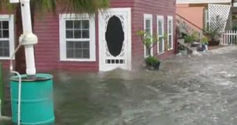
Just Saturday, the Gulf of Mexico “fathered” Debby, the fourth storm of this year's Atlantic hurricane season that meteorologists considered strong enough to be named.
Apparently, Debby's point of origin is located somewhere about 335 kilometers (220 miles) south-southeast of the mouth of the Mississippi River.
Latest reports from the National Hurricane Center inform us that Debby's maximum sustained winds reached 60 mph (95 kph), but that the storm could strengthen in the next 24 hours.
Although, as specialists explain, it is quite difficult to predict the movements of such a weather manifestation, it seems that Debby is presently moving northward.
Thus, according to Our Amazing Planet, warnings have been issued for the areas close to the Mississippi-Alabama border and to the Ochlockonee River in Florida. As well as this, the Gulf Coast reportedly already experienced the impact of the storm.
The same source explains that the threats posed by this tropical storm are both floods – which come as a result of heavy rainfalls – and tornadoes, which break away from the larger storm.
One other source, the Brownsville Herald informs us that several such tornadoes have already destroyed households and have succeeded in bringing down some of the power lines in the region.
Apparently, Stacy Stewart from the National Hurricane Center explained that tornadoes were quite likely to occur with this type of tropical storms, but that nobody could say for sure when and where one was going to strike.
Her exact words were “This is quite common with this type of storm. They tend to not be very large or long-lived, which can be difficult to detect on radar. So people need to keep an eye on the sky.”
With the Atlantic hurricane season coming to an end on the 30th of November, it is expected that by then at least another 4-8 such powerful tropical storms will be formed, and that 1-3 of these will eventually turn into hurricanes.

 14 DAY TRIAL //