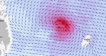
Using a special method called the Dvorak technique, researchers were recently able to create a detailed map of wind speeds that occurred within Typhoon Haiyan as it neared the Philippines a few days ago. This technique was employed because direct measurements are very difficult to collect.
Oftentimes, meteorologists and climate scientists use special airplanes to conduct surveys of tropical storms, hurricanes and typhoons. However, Haiyam is one of the most severe such storms ever recorded, which made such flights impossible. Instead, experts used data from the OceanSat-2 satellite.
The spacecraft is operated by the Indian Space Research Organization (ISRO), and was used alongside NASA's Terra and Aqua satellites to image Typhoon Haiyan in great detail over the past week or so. OceanSat-2 now provides an accurate wind map for this storm.
To get a sense of just how powerful Haiyan is, consider the fact that it even exceeded the Dvorak scale, scoring a total of 8.1 on a scale measuring up to 8. Meteorologists are currently considering creating a new intensity category just for this atmospheric event.

 14 DAY TRIAL //