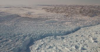
Using data from several sources, a team of investigators with the American space agency was recently able to calculate oceanic ice discharge rates for a large number of glaciers in Greenland. This island is the world's second largest, ground-based ice reservoir, preceded only by Antarctica. If it were to melt entirely, sea levels would rise across the globe.
In order to conduct this investigation, researchers used data collected by a number of NASA satellites in Earth's orbit, as well as readings collected during Operation IceBridge. The latter is a 7-year effort that began in 2009, whose main goal is to provide continuity for data collected by ICESat (the NASA Ice, Cloud, and land Elevation Satellite).
The spacecraft was launched in 2003, and its main scientific payload shut down in 2010. Since then, NASA has been using a fixed-wing aircraft to monitor polar ice changes every winter. Operation IceBridge will continue until ICESat 2 is launched, sometime in 2016. The spacecraft will occupy a low, near-circular, near-polar orbit around Earth.
It was during Operation IceBridge that NASA scientists began looking closely at Greenland's ices. In the new study, the amount of data the team analyzed enabled researchers to gain a new understanding of the processes that lead to ice mass loss on the island. The Operation contributed via ice thickness measurements collected over several years.
Combining these pieces of information enabled researchers at the NASA Goddard Space Flight Center (GSFC) in Greenbelt, Maryland, to determine how glacier flows affect the entire Greenland Ice Sheet, as well as determine that smaller glaciers appear to be more mobile than larger ones. A total of 178 glaciers were analyzed, all of which were more than a kilometer (0.6 miles) wide.
“IceBridge has collected so much data on elevation and thickness that we can now do analysis down to the individual glacier level and do it for the entire ice sheet. We can now quantify contributions from the different processes that contribute to ice loss,” explains GSFC IceBridge project scientist Michael Studinger.
Researchers also included data from the Multichannel Coherent Radar Depth Sounder (McoRDS) instrument in this study. The asset is installed aboard the P-3 Orion aircraft used for Operation IceBridge. With its help, experts determined that ice thickness, glacier valley shape, and ice velocity are the three main factors controlling ice discharges.
“Glacier discharge may vary considerably between years. Annual changes in speed and thickness must be taken into account,” concludes University of Maine glaciologist Ellyn Enderlin, who was the lead author of the new study.

 14 DAY TRIAL //