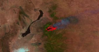
Officials at NASA have just released a series of images detailing how the recently-subdued wildfires in Colorado and New Mexico expanded when they were at their peak. The two comparative images, which can be viewed here, allow you to get a sense of the devastation.
According to statistics, the High Park Fire in Colorado and the Little Bear Fire, in New Mexico, were extremely severe natural disasters, most likely brought on by very dry summer conditions, combined with unfortunate lightning strikes.
Overall, the fires singed more than 100,000 acres of land, destroying hundreds of homes and adjacent buildings in the process. Several thousand people had to be evacuated in order to ensure their safety, and one life was lost.
The comparative images, which researchers plan to use to learn more about the very nature of wildfires, were collected by the Visible Infrared Imaging Radiometer Suite (VIIRS) on the Suomi National Polar-orbiting Partnership (NPP) satellite.

 14 DAY TRIAL //