The Andes are the backbone of South America, a symbol were the greatest civilization in the New World emerged, namely the Inca Empire.
Now a team of Australian geophysicists believe they might have solved the long-standing puzzle of how the Andes mountain range emerged.
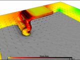
By making the first 3D simulations of the way certain tectonic plates slide underneath one another (subduct), they found that the edges of large plates, like the South American plate where the Andes are located, often present a central zone moving in a conflicting direction.
Scientists were puzzled by the Andes genesis, as most other large mountain ranges - like the Alps or the Himalayas - are the result of the head-on collision between two plates.
The Earth's tectonic activity is driven by subduction areas, where one plate is buried underneath another into the Earth's mantle.
But the 3D model made by a team led by Wouter Schellart at the Australian National University in Canberra is the first to depict how plates move at subduction zones over long time periods. The researchers added fluid dynamics and solid mechanics data to dynamic, seismic and chemical information as far back as 40 million years ago.
This way, the geophysicists could assess how the lateral width of tectonic plates influence how their subduction zones behave. The team discovered that plate's width determines two crucial traits of the subduction zone: the curvature of the contact zone between the plates and the zone's tendency to "retreat" through erosion.
The narrowest plates, between 300 and 1,200 km, have a concave geometry at the edge, retreat relatively fast while broad plates with widths over 4,000 km form convex edge geometry and retreat more slowly.
Surprisingly, the researchers discovered that the subduction zones of the largest plates do not retreat but advance, over periods of 5 to 10 million years!
In Andes, such advancing areas are those where Bolivia Andes are located, and where the western edge of South America is convex. The model showed that the region experiences large compressive stresses due to the westward movement of the South American plate over the Nazca plate in the Pacific Ocean subduction, beginning some 200 million years ago.
South America is pushed westward at a rate of 1.5 cm yearly by the mid-Atlantic ridge and at 160 km off its west shore it collides with the Nazca Plate, creating an oceanic trench 8 km deep.

 14 DAY TRIAL //
