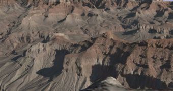
The mapping tool that is so often promoted by the Mountain View company Google is again updated with an impressive amount of detailed terrain imagery that allows you to analyze numerous locations in every world. According to the Google Earth Blog, the new data is 10-meter resolution that means you're able to view almost every detail appearing on the terrain. The same source sustained the data is now three to nine times higher than before so it is probably the biggest update of this period.
"This means when you tilt your view in Google Earth while looking at the new data (using your middle mouse button, the slider in the top right, or your SpaceNavigator), you are seeing terrain features which more closely resemble reality. Also, since the terrain is more accurate, the satellite/aerial photos taken from above stretches over the terrain more accurately. This means the scenery looks much better," the Google Earth Blog reported.
Among the updated terrains, we can mention the Grand Canyon of Arizona and the Grand Tetons in Wyoming so you can try the new imagery by typing this name into the downloadable application Google Earth.
As you might know, both mapping tools developed by the Mountain View company received numerous updates although some of them raised some privacy concerns expressed by the users. For example, the recently-introduced Street View of Google Maps allows you to view street level panoramas with numerous US cities. Because the photos were captured from a car equipped with multiple cameras, the service is now showing private photos with the US residents.
Recently, it was reported that Google Earth was used for the terrorist attacks from the JFK International Airports. Fortunately, the authorities managed to arrest the attackers before they managed to assault the airport and cause a similar disaster with the one on September 11.

 14 DAY TRIAL //