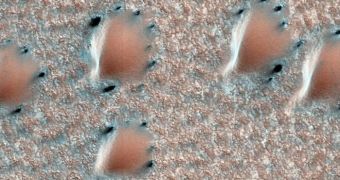
Experts at the NASA Jet Propulsion Laboratory (JPL) announce the release of a new tool for viewing Mars, which allows users to hike over thousands of square miles of surface. All the images included in this viewer were collected in high-resolution, and are freely available to anyone.
HiView, which is available for download here, is based on data collected by the High Resolution Imaging Science Experiment (HiRISE) instrument aboard the NASA Mars Reconnaissance Orbiter (MRO). The spacecraft has been orbiting the Red Planet since 2006.
Since then, it has imaged thousands of square miles in great detail, and all these data have now been centralized into a free application. MRO is managed by the JPL for the NASA Science Mission Directorate, in Washington, DC.

 14 DAY TRIAL //