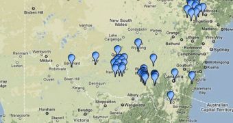
Experts at the European Space Agency (ESA) announce that their SMOS satellite, one of the most advanced Earth-observing instruments it has in orbit, is getting ready to exit its commissioning phase. As part of this effort, a new ground-based verification grid is being constructed around the world, whose sole purpose will be to provide a reference frame to compare the orbital data against. The Soil Moisture and Ocean Salinity Satellite (SMOS), launched on November 2, 2009, is a part of the ESA Living Planet Program, of keeping an eye on the various variables on Earth.
This spacecraft is extremely suitable for conducting soil moisture measurements, but officials say that a reference frame needs to be set up just in case. That is to say, scientists would have no way of knowing the degree of accuracy SMOS has in the data it produces over a certain area, if its instruments have not been calibrated correctly. Basically, what the network does is plant sensors in the ground at various locations, and then compares the moisture data thus produced with the ones that SMOS collects from orbit, in the same region. If significant inconsistencies appear, then something is wrong with the satellite, the thinking goes.
Creating this verification network is inexpensive, compared to the costs of creating misguided policies based on erroneous satellite readings. Simple moisture reading equipment can be installed at almost any location researchers can think off, and the data harvested continuously, or all at once. What the new International Soil Moisture Network (ISMN) provides is the means to “harmonize” the in-situ data collection process at various locations around the globe.
“The International Soil Moisture Network clearly bridges a gap between organizations measuring soil moisture on the ground and people interested in using these data. Both sides have expressed strong interest in the network: many data providers hope to serve a larger community with their data, whereas the data users now, for the first time, have access to globally available datasets in a harmonized format for validating soil moisture estimates from satellites or models,” explains Wouter Dorigo, an expert at the University of Vienna Institute of Photogrammetry and Remote Sensing. The Institute, which is funded by ESA, is in charge of network and data distribution.

 14 DAY TRIAL //