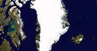
According to a recently-published study, it would appear that the entire island of Greenland rose by as much as a quarter of an inch in 2010. This happened primarily because a lot of ice on its landmass melted away, easing the pressure on the landmass itself.
A similar phenomenon is currently being observed in Antarctica as well. All mountains that contain glaciers, in addition to Greenland and the Antarctic, are pressed down by the tremendous weight of the ice. This even prevents mountains from growing at their natural pace.
However, when the ice begins to melt, that pressure is gradually eliminated, and the landmasses rise. This is what happened to Greenland last year, when a lot of ice melted and made its way into the north Atlantic Ocean.
The main culprit behind ice loss is global warming, and the climate change it is underlying. Higher water and atmospheric temperatures are making it easier for entire ice sheets in both Greenland and Antarctica – the largest ice reservoirs in the world – to separate from land, and float out to sea.
The natural response of the bedrocks below can be measured using sensitive GPS devices installed under the ice at key locations. These instruments can reveal even the slightest ground movements, allowing investigators to track how landmasses react nearly in real-time, LiveScience reports.
Over the past few years, GPS stations throughout Greenland have continuously detected landmass rises of up to 0.6 inches (15 millimeters) yearly. The 2010 growth spike reached 0.8 inches (20 millimeters).
“Really, there is no other explanation” for the increase than the anomalous rate at which ice was lost in 2010, Ohio State University expert Michael Bevis explained last week. He gave a presentation in San Francisco, at the annual meeting of the American Geophysical Union.
“The uplift anomaly correlates with maps of the 2010 melting day anomaly. In locations where there were many extra days of melting in 2010, the uplift anomaly is highest,” the expert said at the meeting.
Unusually warm conditions last year led to Greenland losing as much as 100 billion tons of ice above usual levels. This ice loss mostly affected the southern parts of the island, which is subjected to higher water temperatures.

 14 DAY TRIAL //