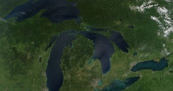
In a recent water availability assessment the US Geological Survey (USGS) conducted on the Great Lakes basin, it was demonstrated that the area has a significant potential for water shortages.
The situation is very worrying, because this particular basin is the largest and widest freshwater system in the world. If it cannot provided water supplies to its surrounding areas at all times, then what system can, researchers ask.
One of the factors the investigators considered in their assessment was groundwater pumping. Actions of this sort apparently had little effect throughout the basin as a whole. However, their consequences were made visible locally, in areas such as Milwaukee and Chicago.
In these two regions, groundwater levels dropped by as much as 1,000 feet over the past few years. It is estimated that current pumping rates will drop these levels by an additional 100 feet within 30 years.
“While there is an abundance of water in the region, we may see local shortages or conflicts because water is not distributed evenly,” explains USGS expert Howard Reeves, the lead author on the study.
“In some areas, the physical quantity of water may be limiting, and water availability in most of the Great Lakes Basin will be determined by social decisions about impacts of new uses on existing users and the environment,” he goes on to say.
For the Great Lakes Basin, the expert adds, water availability is calculated as a function which takes into account factors such as surface water/groundwater storage, flows of water through the system, and also human and ecological uses of said water.
Oddly enough, human development and water use in the Great Lakes area has had little effect on water availability, due to significant annual inflow, the large volumes already present, and the high quality of the groundwater that is made available.
“This Great Lakes Basin study on water availability and use provides important information for restoration and protection of regional water resources and for guiding appropriate economic development of these resources,” says Tim Eder.
“USGS information on consumptive water use also will be useful to the Great Lakes states and provinces to understand and estimate the cumulative impact of water use on regional water resources,” adds the expert, who is the Great Lakes Commission's Executive Director.

 14 DAY TRIAL //