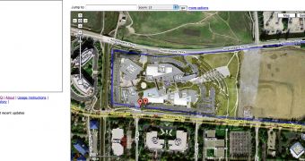
If you're really curios to find out how far you walked from your home to work, then this service is the perfect choice for you. Gmaps Pedometer helps you select a certain location from Google Maps and find out the distance between the starting and the ending point. The idea is quite interesting and sometimes useful because it displays the distance between two points in both English and metric units. As you can see in the picture attached to the article and captured by Matt Cutts, Google employee, the service offers even more functions and allows you to print the map or export the file as a GPX format.
"As a runner training for a marathon for the first time, I found myself wishing I had an easy way to know the exact distance a certain course is, without having to drag a GPS or pedometer around on my runs. Looking at Google Maps, and knowing there was a vibrant community of geeks hacking it, I knew there had to be a way. So here it is," the developer of the Google Maps mashup said in the description of the service.
As you know, this product is not the only Google Maps mashup because there are a lot of other services based on the solution developed by the search giant. Some time ago, I presented you an interesting game based on Google Maps that enables you to fly over a certain location provided by the Google product. Although some of them are useless, Google allows developers to design their own creations and this is good because they might build innovative tools. Until now, this is one of the most useful solutions created with Google Maps because it helps users to calculate the distance between two points and, with a little math, the time required to cover it.

 14 DAY TRIAL //