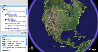
As you surely know, Google Earth allows users to view the entire Earth directly from the satellite, including security areas and some of the secret zones from countries in the entire world. That's why the product was continuously brought in the spotlight, the authorities from multiple countries demanding the search giant to remove or at least blur certain images. Although Google usually agreed, it seems like this is the moment the company refuses to comply with the authorities demand, sustaining several blurry pictures will damage the quality of the application.
Some time ago, the Indian authorities demanded Google to censor certain photos showing the Parliament, the Rashtrapati Bhavan building and other security areas in the country. At this time, the company's decision is still expected by the authorities but it seems Google tends to deny it. The main problem would be that numerous blurry images can make Google Earth lose important users because they might think the quality of the product is low.
"We take security concerns seriously but obscuring images will not help. We have never degraded image quality...The images available on Google Earth are also available for purchase from various satellite companies in market. The government needs to deal with this issue at the level of satellite companies because they are selling images to us...mapping services etc are available commercially...sometimes free of cost and sometimes for a price. If images damage security then they need to talk to satellite companies. Blurring needs to be done by satellite companies...targeting Google Earth will not fix the problem," ContentSutra from India reported today.
Although the decision is very important, the company recorded more similar cases in the past. If you didn't know, some time ago it was reported that terrorists were using Google Earth to organize attacks against the UK troops located in Basra. Google decided to replace the images with older ones captured before the departure of the UK army in the zone.
Google Earth was also tested by Softpedia and it is available for multiple platforms: click on this link for Windows, here for Mac and on this website for Linux.

 14 DAY TRIAL //