Google might receive an unexpected help from the famous rival Yahoo as Flickr may be able to add new features to the popular Google Earth. Dan Catt, Flickr employee, said the photo sharing service can be improved with KML support that will be somehow similar with Google Earth's function. Using the recently introduced Flickr API, the users can view the geotagged pictures from certain groups or from specific regions.
"If you want Google Earth to spin round and show you where the latest photos are when a KML feed updates open up the Info/Properties for the Network Link and turn on "Fly to location on Refresh". Originally I had this served as on by default, but then it got too annoying when you're trying to look at something and suddenly the globe spins 180 to show you the latest photos. Cook to taste," Dan Catt tried to describe a Google Earth trick.
The competition between Google and Yahoo was pushed to another level by the recently rolled out improvement bundled into Yahoo Maps that brings detailed imagery for multiple European countries. Although Google is the clear leader of the category, the Mountain View company struggled to consolidate its position and works on both Google Maps and Google Earth adding new features and abilities. Recently, Google Earth 4.1 beta was quietly made available on the Internet while Google Maps received a lot of updated imagery and photos.
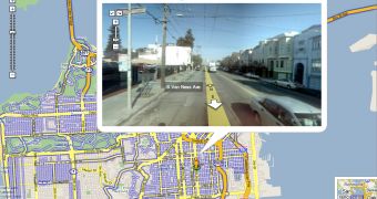
For example, the web-based service was brought in the spotlights by the revolutionary Street View function that provides street level panoramas for free. Basically, the photos were captured with a car equipped with special cameras that took pictures with several cities from US. At this time, Street View is available only for the United States but the Mountain View giants ensure us that it will be soon introduced with imagery from all over the world.

 14 DAY TRIAL //