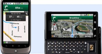
A new, appealing service was made available this week for the Android phone owners, in Australia or New Zealand, namely Google Maps Navigation. Through the new service, users get free voice-guided turn by turn directions in real time, all straight on their mobile phones.
According to Google, the solution should prove very helpful for mobile phone users out there, as all the necessary directions will be offered directly when needed.
While Google Maps for Mobile might not be a new solution for many users, the Google Maps Navigation was made available only for a limited number of users, and only in select markets.
“Google Maps Navigation builds on that by combining the best of Google Maps for mobile, Google Search, and a host of unique capabilities only available on smartphones, like GPS, compass, text-to-speech technology, a permanent Internet connection, and the ability to search by voice,” a recent article on Google's Australian blog reads.
Some of the main features that the new solution bring to Android owners in Australia and New Zealand include Google Voice Search, satellite views, the possibility to view various locations along the route, easy syncing, and more.
Not to mention that it also includes walking navigation, so that users can explore destinations on foot as well. When one would need to make a turn, the phone vibrates, notifying the user. Of course, one can also use voice guidance with the solution.
Google Maps Navigation was made available for all devices based on Android 1.6 or higher in both Australia and New Zealand. Those interested in giving the solution a try should head over to the Android Market to download it on their devices.
According to the aforementioned blog post, the main features of Google Maps Navigation include:
Search instead of type.
Maps Navigation is integrated with Google Search, as well as Google Voice Search. That means you don’t need to know your destination’s exact address, or even its name. You can search instead: try saying “art gallery sydney” instead of “Museum of Contemporary Art”
See where you’re going. You don’t have to download imagery or data or store it on your phone. It’s always connected to the Internet, which means you can access satellite views of your route or preview your destination in Street View.
Explore along the way.
Once you’re on your route, you can search for anything along your route: petrol stations, restaurants, museums, hotels, parks, anything you can think of. Some common searches, like petrol stations, are built in as layers you can turn on and off. Because Google Maps Navigation is integrated with Google Search, you can search your surroundings just as easily as you search the Internet.
Steer clear of traffic.
Maps Navigation displays live traffic conditions on top of your route: red means heavy, yellow means slow, and green means clear sailing. If traffic is looking bad, you can find an alternate route. Road traffic is available in Sydney, Melbourne, Brisbane, Wollongong and Newcastle.
Seamlessly in sync.
Simply sign in to Google Maps on your desktop, click the star next to any result on maps.google.com.au and that place will automatically be starred on your phone, making it easy to remember.

 14 DAY TRIAL //