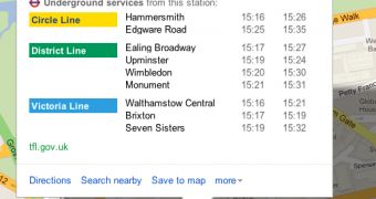
If you're planning to visit London this year, you're not alone. With the Summer Olympics just months away, London will be an even busier place than ever. The influx of tourists is also going to put a strain on public transport, which is why Google Maps is now introducing real-time service alerts for the London Underground.
Any delay or problem will be mentioned in Google Maps, either when getting directions to a place, or when just checking out one of the Underground stations.
The idea is to provide people with real-time data so they can avoid problem areas, permitting them to get where they want, to be faster, while also making sure that the lines or stations affected don't get overcrowded when they need it the least.
"Ahead of a busy summer in London, we are bringing real time service alerts for the London Underground to Google Maps. We’ll let you know of any disruptions on the Underground that are happening at the time you need them most. To see these alerts, click on a station in a timetable or in the public transport directions results," Google explained.
Google Maps already has live transit updates in London, and in many places around the world, enabling you to know when the next train will arrive, the next bus and so on. Now, users will not only be able to see that their train is late, they'll be able to know why. With luck, they'll also have time to find an alternate route.
"In addition to the service alerts in real time, we’ve included planned engineering works for the weekends in our journey planner as well. When planning a trip for the coming weekend, we will show you the relevant subway alerts as part of the directions results," Google detailed another type of data now displayed in Google Maps.

 14 DAY TRIAL //