Google may have shelled out a lot of money for the possibility to collect satellite imagery, but that doesn’t mean it’s just going to keep it for itself. Aside from sharing a good part of it on Google Maps, the company is also giving away some of the pictures in order to support non-profit organizations.
As you may remember, a few months ago, Google acquired Skybox for $500 million, a company that specializes in high-quality imagery gathered via satellites. The company said at the time that the purchase would help improve Internet access across the globe and act as a resource for disaster relief. It would also help better Google Maps.
Julian Mann, Skybox co-founder and developer advocate at Google Earth Outreach, wrote in a blog post that the first part of the plan was underway. Dubbed Skybox for Good, the new project will contribute fresh satellite imagery to organizations who are trying to save lives, protect the environment, promote education, and positively impact humanity.
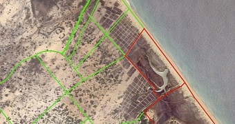
“Today, at our annual Geo for Good User Summit, we announced the Skybox for Good program, under which we will contribute fresh satellite imagery to projects that save lives, protect the environment, promote education, and positively impact humanity. We’ve captured some images of Nagarkovil village in Northern Sri Lanka. HALO Trust previously cleared landmines in this area and used updated imagery to help verify that people are returning, having built 84 houses and cultivating over 40 hectares of agricultural land,” Mann writes.
For the first leg of the program, Google and Skybox will be selecting a group of organizations and acquire the imagery they need to accelerate their work. These images are going to be made available publicly, under a Creative Commons by Attribution license, which means everyone will be able to see and use them.
Google Earth Outreach gives nonprofits and public benefit organizations tools they need to visualize their cause and tell their stories. While this program is in full expansion and more can and will be done regarding it, for now work is going slowly.
Some images are already available for people to check and they have been placed on a map. Some are from West Virginia, where SKyTruth and the Appalachian Voices are monitoring and measuring the rapid expansion of mountaintop-removal mining, but they cover all corners of the world. Requests have been made for many areas, including in Indonesia, India, Liberia, Brazil and Lima, to name just a few.

 14 DAY TRIAL //