 14 DAY TRIAL //
 Google Earth is a downloadable application provided by Google that helps you view maps and other imagery with the entire world directly from the desktop of your computer. Some time ago, the program was updated with Google SketchUp support that allows users to create their own 3D models of cities, streets or buildings to include them into Google Earth. Since the release of the function, the company received numerous drawings designed in the 3D modeling tool that are available on the official page of the product. As you surely know, Google Maps is a similar product powered by Google that offers almost the same functions as the downloadable tool but it is accessible using a web-based interface.
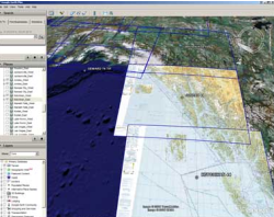
Today, the company releases an updated version of Google Earth that contains Keyhole Markup Language support, a new function meant to improve the information provided by the application. This new feature provides users geobrowsing and exploration abilities helping them to find geographic details directly from the window of the program.
"Search is at the heart of everything we do here at Google. That's why I'm excited to announce a new innovation in search available today in Google Earth. Users can now search through all of the world's Keyhole Markup Language (KML) files, making the millions of Google Earth layers on the Web instantly accessible for geobrowsing and exploration. Last month, we encouraged you, our Maps API users, to create KML site maps for your mashups. Today's launch is the next step towards making those sitemaps - and all of the world's geographic information - discoverable by users worldwide," Chikai Ohazama, Product Manager, Google Earth Team, sustained in a blog post published on the official page of the product.
Google Earth was also tested by Softpedia and it is available as a free download on this link.