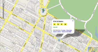
The web-based service Google Maps is surely the most popular map solution on the Internet. This popularity is obviously attracting suggestions for new features, most of them being really evaluated by the search giant. One required feature was finally debuted today, Google implementing bus stations and departure times for several cities. Additionally, you should be able to view train and metro stations represented by tiny icons appearing on the map.
"Depending on the data available for a given public transit system, Google Maps now shows the next departure times, what lines serve a specific station, and/or a link to the transit agency to get more detail," Christoph Oehler, Product Manager, said today. "For some cities we even provide a trip planner for public transportation. Here too we're working to expand the cities that we cover, so stay tuned," he added. This latest feature is based on the stand-alone service Google Transit that allows you to create transit trips based on maps and addresses.
This May was at least important for the two map products owned by the Mountain View company, Google Maps and Google Earth that received several new and useful features. First, it was Google Maps that received street imagery for a lot of locations from all over the world. Then, the parent company quietly released a new version of Google Earth, 4.1 beta that brings some new features for the downloadable application. For example, the interoperability with the web-based service allows you to view a certain location straight into the window of your browser. Then, Google Maps returned and received a new update, the Street View function being one of the most innovative features ever implemented into the service.
If you want to download Google Earth, you can take it straight from Softpedia for free using this link.

 14 DAY TRIAL //