One of Google's most successful applications is definitely Google Earth, and its shareware version is equally used by thousands of people around the world for viewing and analyzing large batches of information from several sources. Google Earth Pro enables customers to perform a wide range of studies, such as designing in-depth presentations for potential clients or analyzing the environmental consequences of various natural disasters.
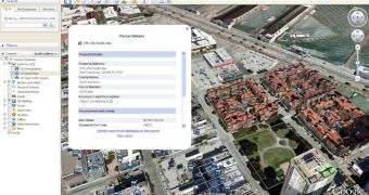
The latest version of Google Earth Pro is 5.2 and the developer team has enhanced it with numerous new features and improvements, like inserting new data layers that will help users discover details about the U.S. population much easier than before. According to Google LatLong Blog, the new added layers are U.S. Demographics (deals with demographic data from 2010 and estimated 2015 values at the state, county, tract, and block group level), U.S. Parcel (includes critical parcel and building information) and U.S. Daily Traffic Counts (will offer access to the average number of vehicles that have passed through an intersection).
Another enhancement in the latest release of Google Earth Pro is that it currently offers the possibility to import and process large data sets of GIS information, thus permitting users to manage their complex vector files or high resolution pictures in a highly interactive manner.
This improvement is based on the same technology used to create all the Google Earth layers, and it functions by dividing the data into several smaller files than can be loaded more easily – therefore, only the information you require will be visible while the speed and performance are maintained at high levels. Due to this vector data regionation, Google Earth Pro 5.2 can prevent data blockages and will still display the points you want to work with.
Another new feature added to Google Earth Pro is that it currently allows users to save created paths or polygons as KML files. In other words, you will be able to share your measurements with other colleagues or analyze and modify your data at a later time. Furthermore, you will have the chance of visualizing measurements of existing paths and polygons and to quantify the data that could only be inspected visually.
Google Earth Pro can be purchased from Google's online store or evaluated for 7 days as a free trial.

 14 DAY TRIAL //