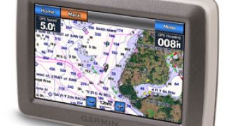
Besides offering car drivers a full-range of devices, Garmin's lineup also includes quite a few models designed to be used during adventure trips, on water and even in the air. Furthermore, some of its products are actually able to carry out several such functions, and that's exactly the case with the newly-announced GPSMAP 600 series, which offers extensive navigation functions for both land and seafaring, while at the same time enclosed in a very sturdy and rugged external casing.
Garmin's new family of portable navigators includes, at least for the time being, the GPSMAP 620 and GPSMAP 640 models, designed either for the US (640) or international (620) markets. Both models provide extensive navigation options, as well as a high-sensitivity GPS receiver and a waterproof (IPX7) super-bright 5.2-inch WVGA touchscreen display (800 x 480 pixel resolution).
There are some differences between the GPSMAP 620 and 640 models, mostly related to the pre-loaded maps. Thus, while the 620 offers just a worldwide basemap with shaded relief (but also supports additional maps or marine information via an SD slot), the GPSMAP 640 is much more complex, since it's been pre-loaded with street maps of North America and worldwide shaded relief mapping in addition to detailed U.S. coastal BlueChart g2 charts.
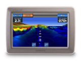
By using the optional BlueChart g2 Vision technology, the GPSMAP 640 offers a 3-D "mariner’s eye view," for a navigation perspective above the waterline, and a "fish eye view" for an underwater 3D bathymetric contour perspective. Also available for boaters will be the g2 Vision data card, which suggests the best navigational route. In addition, photo references give detailed aerial views of points of interest (POI) such as ports, marinas, waterways and landmarks.
Another interesting feature of the GPSMAP 640 is represented by its ease of use. Thus, all the users have to do in order to get a certain functioning mode working (either marine or automotive) is to place the device in the corresponding mount and the specific navigation features (maps, POIs, etc.) will be automatically activated.
As expected, the new GPSMAP 600 Series models are a lot more expensive than usual navigators, retailing for either 1,000 US dollars (the GPSMAP 620) or 1,200 US dollars (the 640).
We are just a few, but there are many of you, Softpedia users, out there. That's why we thought it would be a good idea to create an email address for you to help us a little in finding gadgets we missed. Interesting links are bound to be posted with recognition going mainly to those who submit. The address is  .
.

 14 DAY TRIAL //
