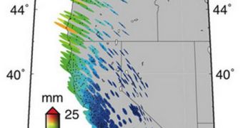
Researchers in the United States are now using Global Positioning System (GPS) measurements to gain additional insight into how oceanic tides are influencing the surface of the planet. The amount of stress they must place on Earth's crust is tremendous, scientists suspect, and GPS is here to help them.
For most, GPS is just a convenient tool to use so as not to get lost on the road. But for seismologists and planetary scientists it is a way of keeping tabs of the way Earth's surface moves, deforms or gets distorted as a result of processes going on within.
Understanding this can in turn provide more insight into the way Earth's interior is set up. The amount of seismic or volcanic activity that is recorded around the world is dependent on what goes on below the crusts, so knowing this can lead to tremendous progress in early warning systems.
Experts at the California Institute of Technology (Caltech) have moved from studying Earth's interior through seismology and laboratory experiments to studying it via GPS measurements.
“At its most fundamental level, seismology is sensitive to specific combinations of these properties (sensitivity and elasticity), which control the speed of seismic waves,” explains Mark Simons.
“However, it is difficult using seismology alone to separate the effects that variations in density have from those associated with variations in elastic properties,” adds the expert.
He holds an appointment as a professor of geophysics at the Caltech Division of Geological and Planetary Sciences Seismological Laboratory. Simons conducted the work with scientist Takeo Ito, an assistant professor of Earth and planetary dynamics at the Nagoya University, in Japan.
The team is using GPS data to measure how a solid planet would respond to the stress being placed on it by tidal forces. The preliminary conclusions of their work were published in the latest issue of the esteemed journal Science Express.
Using GPS receivers installed across the western United States by the Plate Boundary Observatory (PBO), the group is keeping tabs on modifications of as little as 1 millimeter, that may appear in the crust due to tidal forces.
Determining the properties of the asthenosphere is the primary goal of the research. This is a layer of the upper mantle that is located just below the crust, and which is weak and viscous.
“The asthenosphere plays an important role in plate tectonics, as it lies directly under the plates. The results of our study give us a better understanding of the asthenosphere, which in turn can help us understand how the plates move,” Ito explains.
“It is amazing that by measuring the twice-a-day centimeter-scale cyclic movement of Earth's surface with a GPS receiver, we can infer the variation of density 220 kilometers below the surface,” Simons adds.
“The method we developed for gathering data from GPS devices has significant potential for improving 3D images of Earth's internal structure,” Ito concludes.
Funds for this study came primarily from the US National Science Foundation (NSF) and the Japanese Ministry of Education, Culture, Sports, Science and Technology (MEXT).

 14 DAY TRIAL //