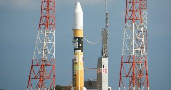
The Global Precipitation Measurement (GPM) Core Observatory satellite has been attached to its H-II carrier rocket and erected on Launch Pad I at the Tanegashima Space Center, on Tanegashima Island, in Japan. The spacecraft arrived at its launch site today, February 27, and is scheduled to take off into space on February 28.
The satellite is an ambitious project developed by NASA and the Japanese Aerospace Exploration Agency (JAXA). Its takeoff is currently scheduled for 1:37 pm EST today (Thursday), or 3:37 am Friday morning, Tanegashima local time. The delivery system will be refueled a few hours ahead of ignition, Japanese officials say.
Once in space, the GPM Core Observatory will provide global rain and snow measurements once every three hours and will provide a dataset to bridge information collected by several international satellites and constellations, including from the United States and Europe. The spacecraft will also allow for upcoming satellites to join in on the new integrated system as well.
One of the two main instruments on GPM is the Dual-Frequency Precipitation Radar (DPR), a dual-frequency instrument capable of providing accurate, 3D readings of storm structures. DPR will also be able to measure the intensity of precipitations across its wide readings swath.
The second main instrument is the GPM Microwave Imager (GMI), a passive sensor that will use its 13 bands to quantify and analyze the intensity of microwave energy emitted by both Earth and its atmosphere. Its resolution will be impressive, since its observations swath is around 885 kilometers (550 miles) wide.
Furthermore, the satellite will contribute to surveying natural disasters as they happen, to forecasting global weather patterns, and to understanding our planet's water energy cycles.

 14 DAY TRIAL //