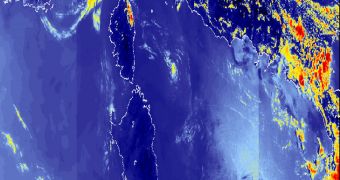
The Sentinel 3 satellite, which is tentatively scheduled to launch around 2013, will provide a new perspective on our planet from its orbital perch, thanks to the advanced instrument suite that it will carry.
The mission is being developed as the third of five components in the Global Monitoring for Environment and Security (GMES) initiative, which was ordered by the European Union.
The European Space Agency (ESA) is currently supervising the construction of the satellite. When launched, Sentinel 3 will provide more advanced observational capabilities than the agency has today.
The primary objective of the mission will be to produce surface-wave information for maritime safety, as well as creating ocean-color products such as maps.
Additionally, it will also be able to provide ocean-current forecasting services that rely heavily on datasets such as surface temperatures, sea-water quality and pollution-monitoring services.
Some of the instruments that will go on the ESA satellite include a precision radar altimeter, an infrared radiometer, as well as a wide-swath ocean and land color radiometer, the agency reports.
These tools have already demonstrated their potential in tests, and officials say that using them from space would be the equivalent of putting a new pair of glasses on existing satellites.
With the first GMES satellite launch planned for 2013, ESA is considering launching the second spacecraft soon after, maybe in the same year. The goal here is to maximize cover as fast as possible.
To that end, the Ocean and Land Color Instrument (OLCI) and the Sea Land Surface Temperature Radiometer (SLSTR) tools that will go on Sentinel 3 have already undergone testing last year.
The Sentinel-3 Experiment campaign (Sen3Exp) was designed in such a manner that it closely simulated the type of data acquisition that the instruments would have to be capable of in space.
Sen3Exp was a massive research effort, ESA says. It involved more than 50 ground instruments, 6 satellite-based instruments, 3 airplane-based hyperspectral instruments, as well as the participation of about 60 scientists from the EU and Canada.
The campaign itself took place in Spain, Italy, as well as over the Ligurian and Adriatic Seas, both of which are in the Mediterranean Sea.
“The campaign was a tremendous international effort that provided a unique and important dataset for the preparation of the Sentinel-3 mission and possibly beyond,” says Sen3Exp principal investigator, Carsten Brockmann.

 14 DAY TRIAL //