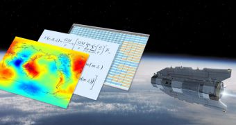
Officials at the European Space Agency (ESA) say that the first data batches from their GOCE satellite have finally been posted for public use on the agency's websites. The mission, which launched back in March 2009, has had a very smooth ride (literally), and is currently beginning to produce the first datasets that experts can actually use to inform policies and to conduct scientific experiments. The general goal of the new mission is to map the minute variations that appear in the gravity pull of our planet at certain locations.
Experts who designed the mission also ensured that the satellite would be able to do this with unprecedented accuracy and spatial resolution. “GOCE is proving to be a remarkable Earth science mission and we are more than confident that these data will not only change the way we see the gravity field of our planet, but also the way the gravity field information is used in many branches of the geosciences,” explains Rune Floberghagen, who is the GOCE mission manager at ESA. The most important instrument on the Gravity Field and Steady-State Ocean Circulation Explorer is a high-sensitive gradiometer, a device that can easily identify gravitational variations in the land and sea.
According to ESA representatives, the first full gravity field model (containing level-2 data, the most advanced information derived from GOCE readings) will be made available soon. The team plans to present it between June 28 and July 2, at the ESA Living Planet Symposium, which will be held in Bergen, Norway. “The Living Planet Symposium will in many ways be a coming-out event for GOCE. We will spend two full days on the findings of the mission so far, and we certainly expect the release of our first gravity model to mark the beginning of a long and successful series of gravity field models based on GOCE’s novel measurement techniques,” Floberghagen believes.
Before reaching this level of complexity, the data that make up the GOCE datasets first need to be calibrated and processed. The satellite beams back telemetry to listening stations in Sweden and Norway, which then send them to the ESA European Space Operations Center (ESOC) Flight Operations Segment. Once here, the information is sent to Frascati, Italy, at the European Space Research Institute (ESRIN), where it undergoes an important process of validation and calibration. The end result is a series of “level-1b” data products.
It is then converted to level 2 data through the High-level Processing Facility (HPF), a collaboration of universities and research institutes that have complementary expertise in gravity and geodesy-related science fields. “After an intensive calibration and validation phase, we are all very happy to see the science community at large getting involved in the exploitation of the data,” says Floberghagen.

 14 DAY TRIAL //