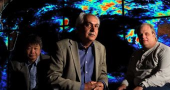
An University of California in Irvine (UCI) engineering professor and his team are at the forefront of precipitation analysis, with a series of new maps they are producing for the United States and countries around the world.
Increasingly often, authorities from a variety of nations turn to UCI professor Soroosh Sorooshian and his group for maps that show them when and where they could expect heavy rains and snow.
These past few months have been somewhat strange as far as precipitations go. Suffice it to consider the case of California, which got in a week all the rain it normally gets in a year.
Another situation developed in Australia, where torrential rains led to the greening of the otherwise-yellow continent. While grain production will most likely reach record levels, a large number of floods have also occurred, with a variety of side-effects.
The main functionality of the online virtual maps is to help governments around the world predict and prepare for intense precipitation events, such as heavy rains and blizzards.
“Some climate modelers predicted drought for Southern California, and instead we exceeded a year’s worth in a week. Australia’s been getting lots too,” the expert says.
Sorooshian also holds an appointment as the director of the UCI Center for Hydrometeorology & Remote Sensing. The data the Center produces are widely available for the scientific community, and also entirely free.
In order to come up with the most relevant products, the organization is in constant contact and collaboration with UNESCO – the United Nations' science arm – and US agencies including the National Oceanic and Atmospheric Administration (NOAA) and NASA.
“What we provide, essentially, is the fuel for hydrologic models that can predict things like the extent and timing of flooding downstream,” Sorooshian explains.
The expert is the UCI Distinguished Professor of civil & environmental engineering, and of Earth system science, at the university.
“If Pakistan had been able to see the patterns of water from far off, it could have better prepared and saved many lives and livestock,” he adds.
“It’s similar to what happened after the 2004 tsunami in Indonesia; now an early warning system is in place. These things are very important,” the expert concludes.

 14 DAY TRIAL //