 14 DAY TRIAL //
 Google Earth received an impressive imagery update after a National Geographic layer was included into the downloadable application. The search giant's program was updated with National Geographic stories, images, journals and a live webcam from Africa, all of them being accessible with ease from Google Earth for Windows and for Mac OS X. All you need to do is to enable the National Geographic layer and start enjoying the panoramas. The most impressive update is represented by the Mike Fay's Megaflyover pictures that were captured in approximately one year.
According to Michael Jones, Google Earth CTO, the entire process of taking photos with the content was described in September 2005 in National Geographic. Google Earth shows only 500 pictures selected by the scientist, most of them showing people, animals and sign of human presence in Africa. The downloadable application now displays a red airplane icon that provides instant access to these photos.
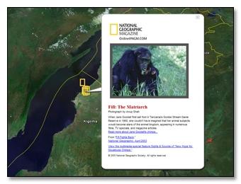
"Across Africa, you will see the familiar yellow National Geographic logo. Zoom in to see the title of each feature article or photograph. Click the icon and a pop-up balloon shows a photo and description along with links to the content. Follow those links to read the entire story right where it happened. Not only will you learn about Jane Goodall's Fifi, you'll see her home," the Google employee said.
This month, the Mountain View company improved both Google Maps and Google Earth with impressive features, a move that seems to be a powerful hit for the rival's products. For example, Google Maps was updated with Street View, an awesome function that shows street-level panoramas with several US cities. Also, the search giant quietly released a new version of Google Earth, 4.1 beta that introduces interoperability with Google Maps.
If you want to download the latest version of Google Earth, you can take it straight from Softpedia.