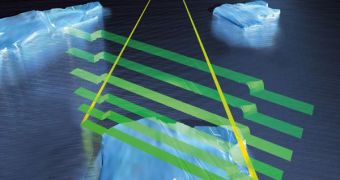
On February 25, the European Space Agency (ESA) is set to launch the most advanced satellite aimed at surveying ice sheets ever deployed. CryoSat will have an extreme sensibility to even the most minute changes, as it will feature a high-performance instrument suite that will allow it to keep track of several parameters at the same time. One of its primary goals is to map the ice thickness over water and land, engineers behind the spacecraft say.
The satellite will be launched aboard a Russian Dnepr delivery system, from the Baikonur Cosmodrome in Kazakhstan. Lift-off is scheduled to take place at 14:57 CET (13:57 UTC) on Thursday, February 25, if the weather allows it. The spaceport is operated by the Russian space agency RosCosmos, whereas the launcher is under the control of the international space company Kosmotras, ESA representatives write on the agency's website. The satellite will be injected into an orbit 700 kilometers above the surface of the planet. From this vantage point, it will be able to conduct accurate observations of the ice masses it is set to target.
“The 700 kg CryoSat spacecraft – whose name comes from the Greek kruos meaning icy cold – carries the first all-weather microwave radar altimeter. The instrument has been optimized for determining changes in the thickness of both floating sea ice, which can be up to several meters, and polar land ice sheets, which in Antarctica can be up to five kilometers. The mission will deliver data on the rate of change of the ice thickness accurate to within one centimeter,” the press release reads.
One of the main reasons why this mission was put together was the fact that the changes happening on the Earth's pole on account of global warming and climate change were beginning to evolve rapidly. Climatologists therefore needed a tool capable of producing sensitive measurements of the regions of interest, covering the recent record-lows in the extent of summer Arctic sea-ice cover. Additionally, scientists also need to be able to determine how the thickness of the ices is changing around the year. A better understanding of these dynamics will contribute to climate-change studies, and will provide more variables for computer models.

 14 DAY TRIAL //