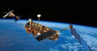
For the last time ever, the European Space Agency has paired up its ERS-2 and Envisat satellites in Earth's orbit, so that the two spacecraft can produce three-dimensional maps of low-lying coastal areas and glaciers around the world.
The two instruments worked together in the past several times, and each sortie they flew ended in resounding success. When the pair flies in formation, it can produce a lot more data than each individual satellite.
In other joint flights, the two spacecraft measured the speed of fast-moving glaciers, detected land-ice motion and developed elevation models over flat terrain. The 2010 campaign is a continuation of those efforts.
The thing that makes this combination unique is the fact that the satellites can combine data they collect via their respective synthetic aperture radar (SAR) instruments.
As information is collected a short time apart, the double mission can detect changes that would otherwise occur too rapidly for a single satellite to detect. Envisat flies 30 minutes apart from ERS-2.
In past flights, researchers were for example able to determine that some of the fastest-moving glaciers in the world were flowing by as much as 1 centimeter in 30 minutes. These glaciers can move downhill at a speed of 200 meters per year.
The basic technique that ESA uses to combine the two SAR datasets is called SAR interferometry, or InSAR, and is similar to optical interferometry used in astronomical observatories to combine the light from two or more telescopes into a single image.
InSAR has proven to be extremely accurate in detecting any sort of deformations that may appear in the surfaces it analyzes. It can also monitor glaciers with great precision, and create digital elevation models (DEM) as a result.
“These measures are of great interest for monitoring the fast dynamic of sea ice and for identifying the ground ice line,” explains the technical director of the Switzerland-based Sarma, Dr Paolo Pasquali.
“We have also plenty of other very nice sea ice examples obtained during the first and second tandem campaigns over the Northern Canada-Alaska region,” he goes on to say.
ESR-2 and Envisat finished their last joint mission on October 22, just before the latter was moved to a lower orbit, to preserve fuel and extend its life span.
Officials at ESA say that all the datasets the last joint sortie produced will be made available to those interested as soon as the information is processed and then validated.

 14 DAY TRIAL //