, which corresponds to the size of Corsica.")
 14 DAY TRIAL //
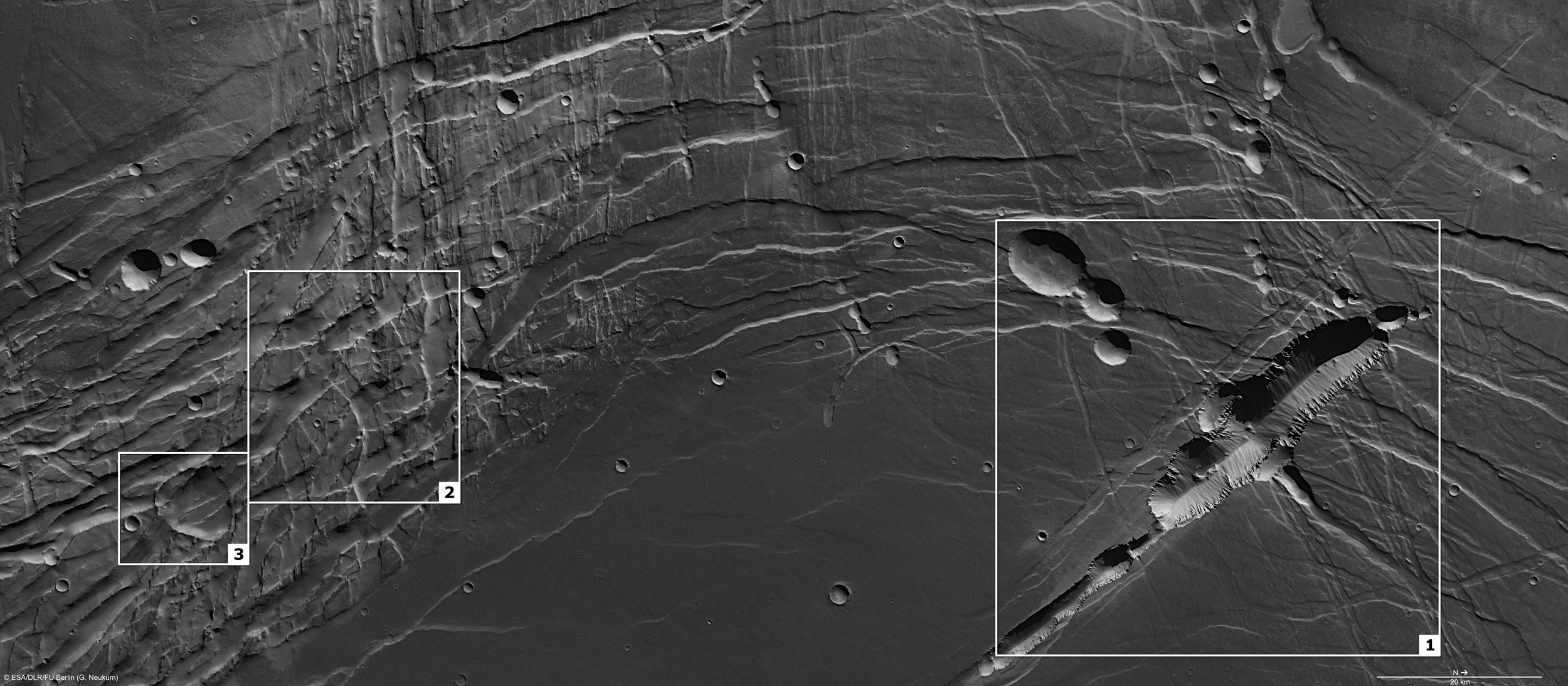
 The European Space Agency has revealed new images of the Phoenicis Lacus region on Mars, an area that was first noticed by nineteenth-century astronomers.
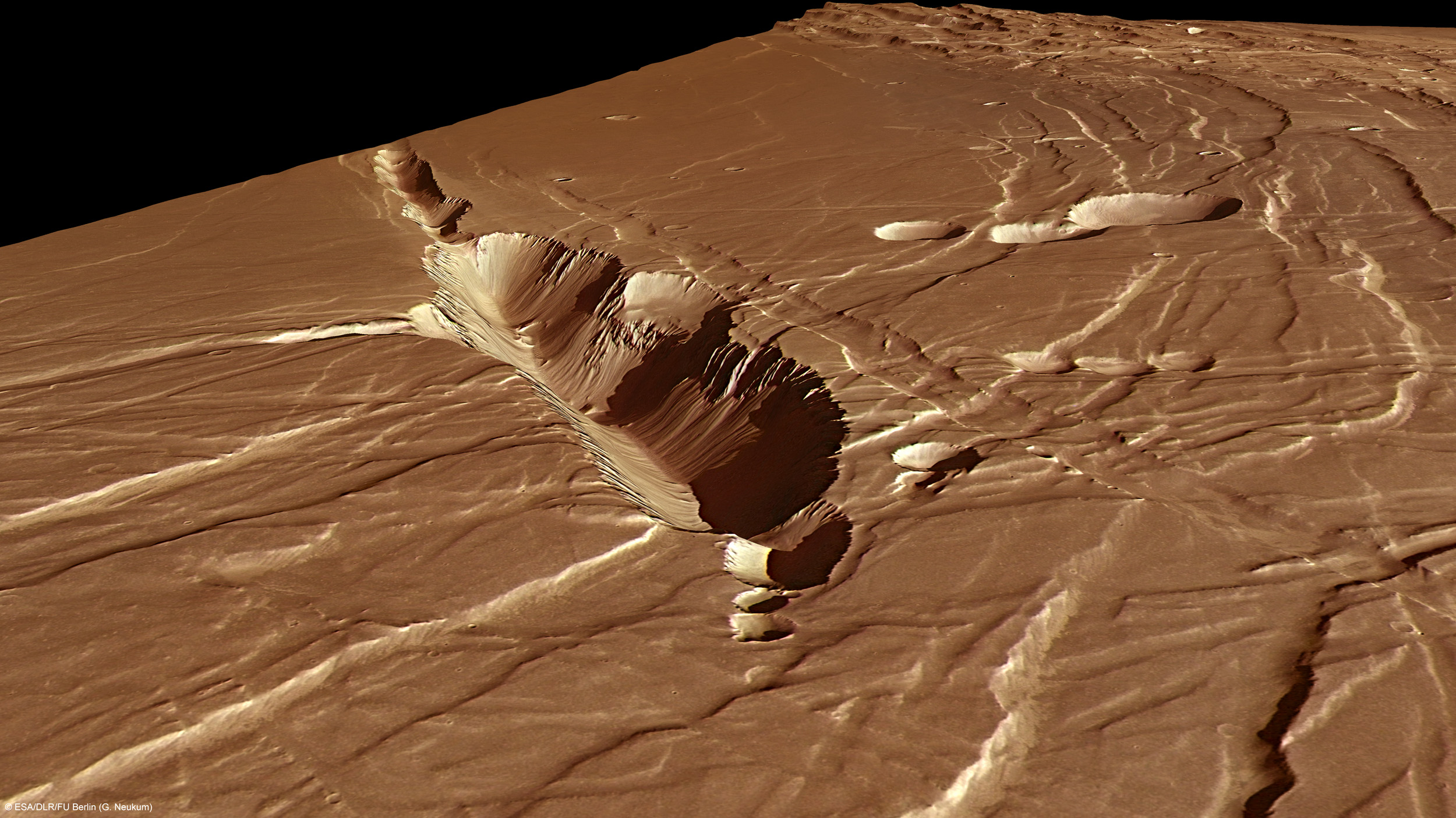
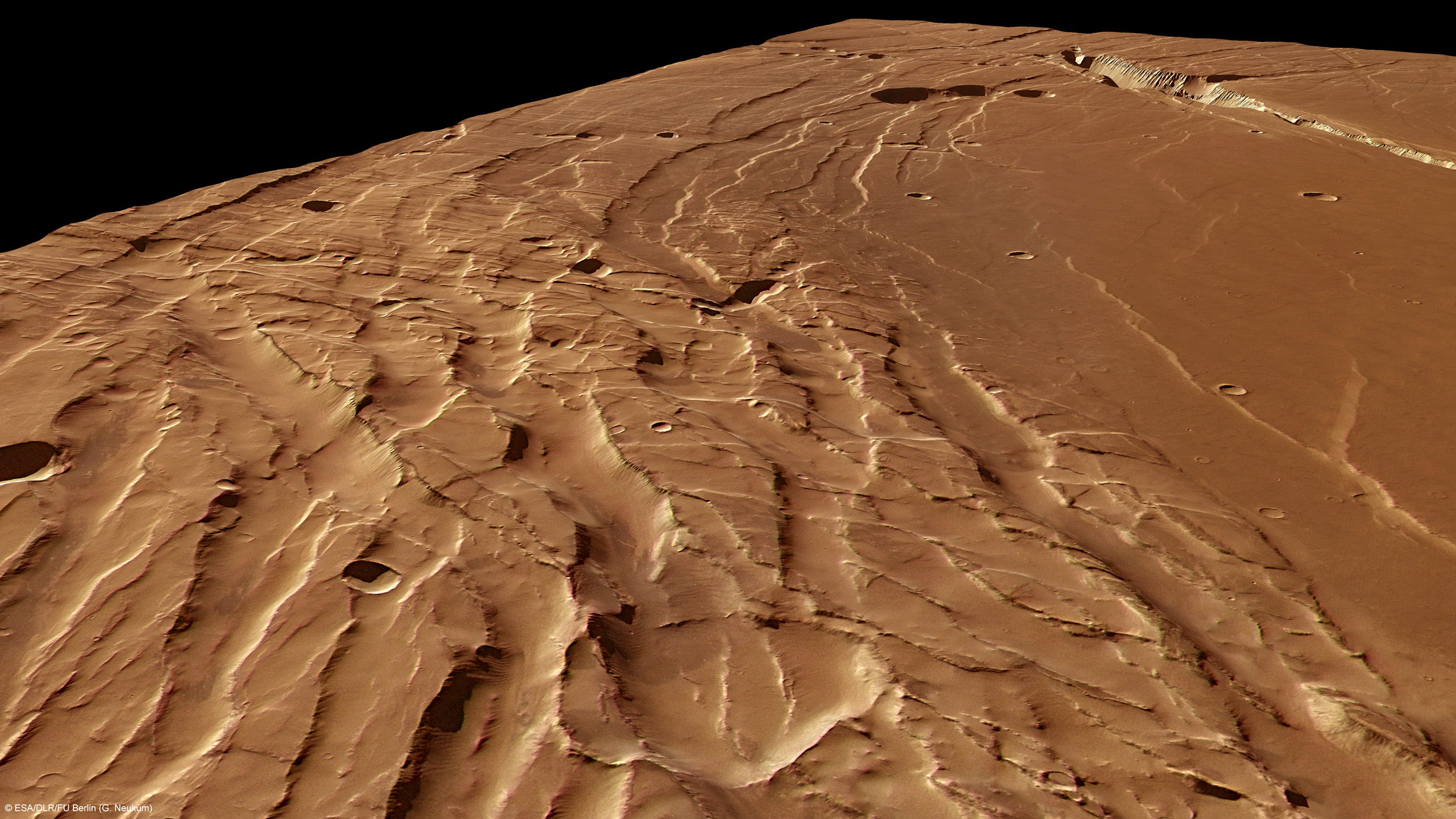
These high-resolution pictures show the places where complex fault lines in the Phoenicis Lacus region have resulted in landscape with a distinctly contrasting appearance.
The first thing that planetary astronomers notice is still the brightness of a surface, known as the albedo.
It is partly determined by the composition of the surface material, for example rock will be less reflective than ice.
Another very important part is played by the texture of the surface itself, because smooth surfaces will always reflect more sunlight, and will appear to be brighter that rough surfaces.
19-century astronomers identified the Phoenicis Lacus region as a dark spot and mentioned that it looked very much like a sea.
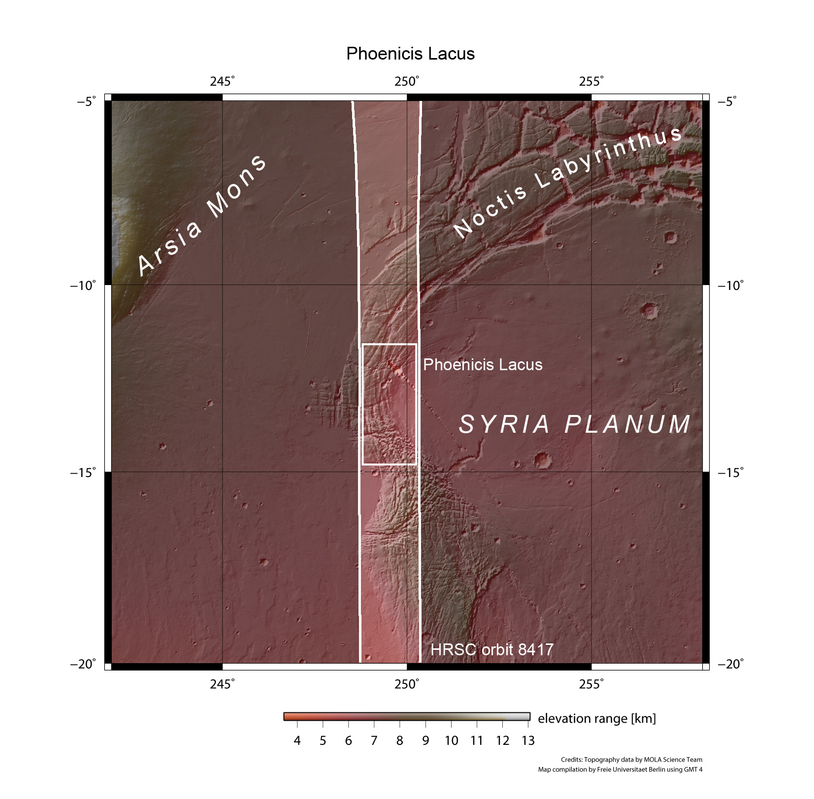
We know today that it was never a body of water, instead it is the southwestern extension of the complex Noctis Labyrinthus system, which pulls away from the giant volcanoes of Mars’s Tharsis region.
Phoenicis Lacus has an area of 8100 square kilometers, almost the size of Corsica, but only a little piece of it appears in the image taken on 31 July 2010 with the High-Resolution Stereo Camera (HRSC) on ESA’s Mars Express spacecraft.
The HRSC on the ESA spacecraft Mars Express got the images of Phoenicis Lacus at approximately 13°S/249°E.
Phoenicis Lacus was formed by the rise of the Tharsis plateau, and the thing is that the constant episodes of strong volcanic activity in Tharsis not only lifted the plateau, but they also deformed Phoenicis Lacus, by creating blocks and several fault lines with different orientations.
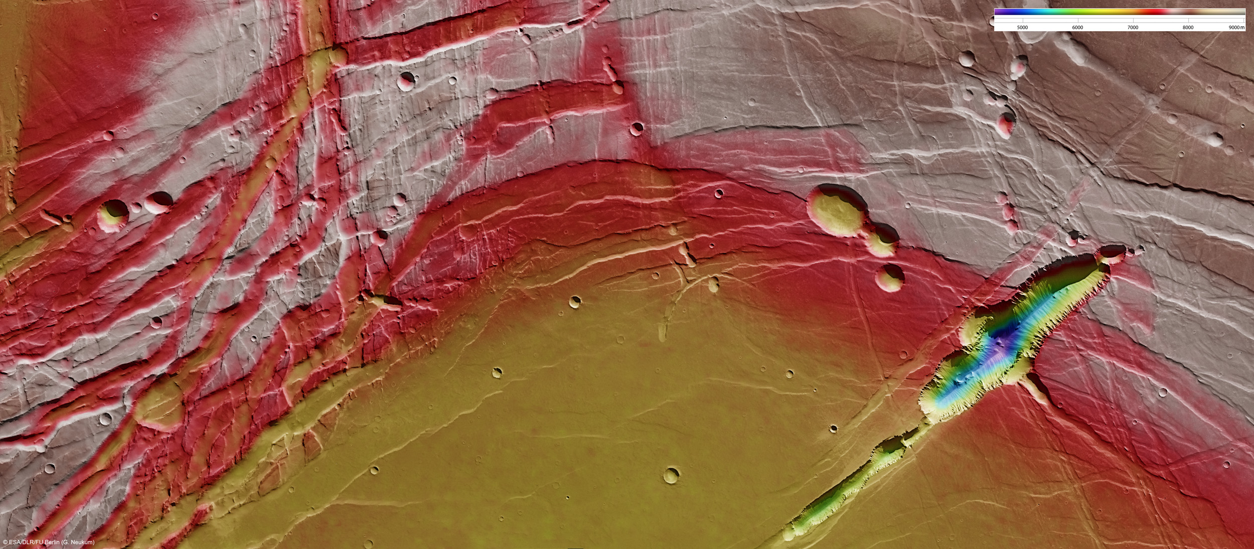
The consequence of the extension of the plateau is the cliffs and valleys landscape that is visible now, along with a prominent collapse feature in this region.
Images also show that the Phoenix Lake looks like a long pit, with depths of nearly 3 km below the surrounding plains.
On the walls we can see extensive basalt layers and a small field of sand dunes is covering the floor.
On the left side of the image we can see an impact crates, which was extended during the spreading of the graben and evolved from a circular to an ellipsoidal form.
The other large bowl-shaped structures are most likely collapsed structures.