14 DAY TRIAL //
 This Monday, the European Space Agency released a view of the Great Barrier Reef off the east coast of Australia, as seen from space.
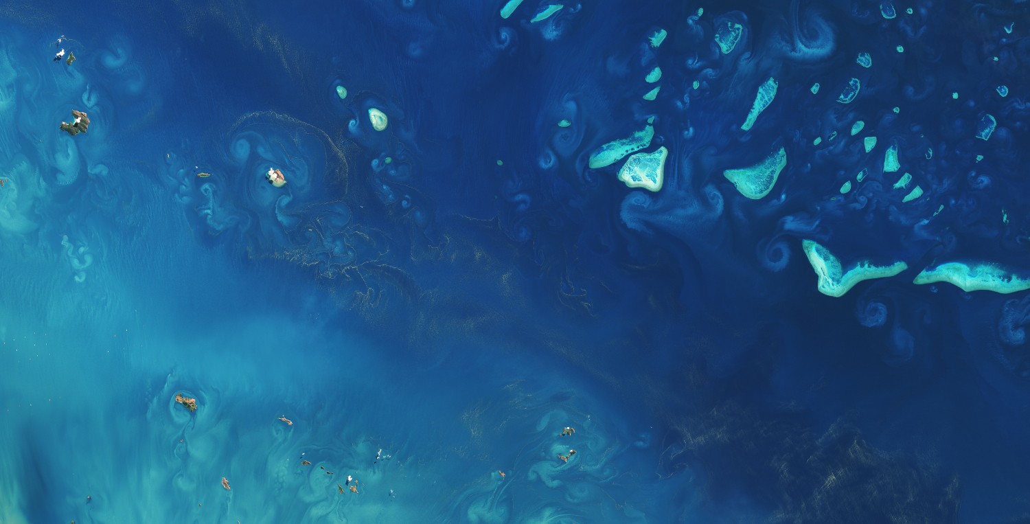
The image, available in the gallery below, was obtained by the Landsat-8 satellite quite a while back, in August 2013, and shows currents swirling around corals in this corner of the globe.
It is understood that the Landsat-8 satellite taken this photo of the Great Barrier Reef close to Australia from an altitude of about 800 kilometers (approximately 500 miles).
Together with other space probes, the Landsat-8 satellite often images coral reefs around the world to help researchers keep tabs on the health of marine ecosystems.
“Satellites offer the means to monitor the health reefs across the globe - as well as other parameters that indicate the overall health of oceans,” specialists explain.
“Optical satellite imagery, like what we see here, can be used to monitor the ocean color and detect harmful phytoplankton blooms. They can also help map the ocean floor at shallow depths,” they add.
It is estimated that the Great Barrier Reef covers an area of about 344,000 square kilometers (nearly 133,000 miles). The ecosystems is home to thousands of marine species.
The bad news is that, in this day and age, the Great Barrier Reef is threatened by pollution, ocean acidification, climate change, and unsustainable fishing practices.